


ABC57 First Warning Neighborhood Weather Forecast
Tuesday, April 20th, 2021
Wet pavement and drizzle this morning. A rain/snow mix moves in later in the morning as temperatures into the mid 30s. The wintry mix changes over to mainly snow Tuesday afternoon but the best chance of snow accumulating will be Tuesday evening. Most areas will see less than 2" of snow. Most of the system moves out by tonight. It remains chilly on Wednesday with a chance of drizzle and flurries.
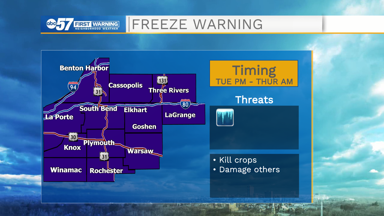
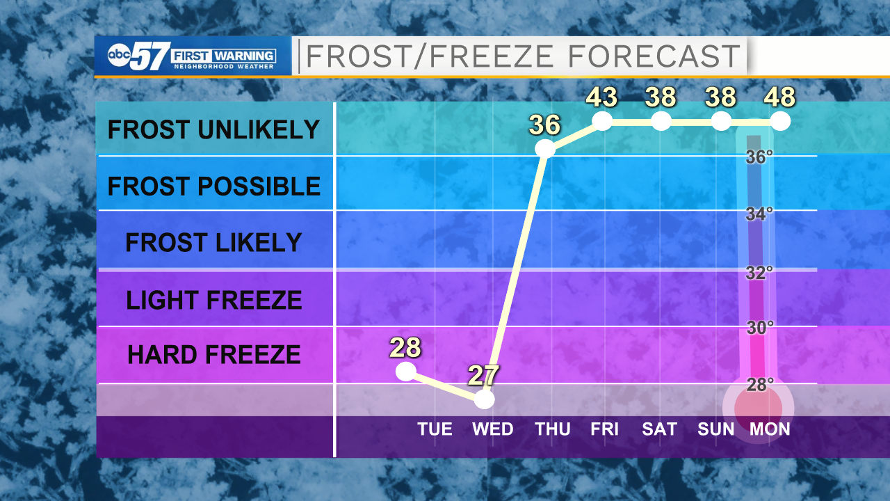
The biggest impact is going to be overnight lows falling below freezing tonight and Wednesday night. This will likely kill any uncovered sensitive vegetation and be a big impact to local fruit farmers.
The rest of the work week is fairly bright as temperatures rise back near 60F. There is a chance of rain on Saturday but Sunday is nicer with a high in the mid 50s. Next week looks much warmer.
Today: Wintry mix. High 39.
Tonight: Mostly to partly cloudy. Low 28.
Wednesday: Mostly cloudy, drizzle possible. High 46.
Thursday: Sunny. High 54.