Barry brings heavy rain threat Tuesday, then tropical humidity

-
2:00

Annual Studebaker car show takes over Ironwood Plaza
-
0:55

Beautiful weekend expected
-
1:05

Truly wonderful conditions
-
0:41

High-speed pursuit ends in collision after driver flees police...
-
2:15

Fort Wayne Tin Caps put an end to the SB Cubs winning streak
-
1:21

This weekend is the annual Hall of Heroes Comic Con
-
0:46

Elkhart Police Department respond to shots fired call at the...
-
3:55

ABC57 speaks with Cass County Commissioners, Judge and Interim...
-
2:48

Common Council to consider appeal options following South Bend...
-
0:52

South Bend seniors explore local parks, event centers, and available...
-
1:51

Mentone Egg Fest celebrates 80th year
-
4:58

New reactions after Notre Dame releases findings of priest sex...

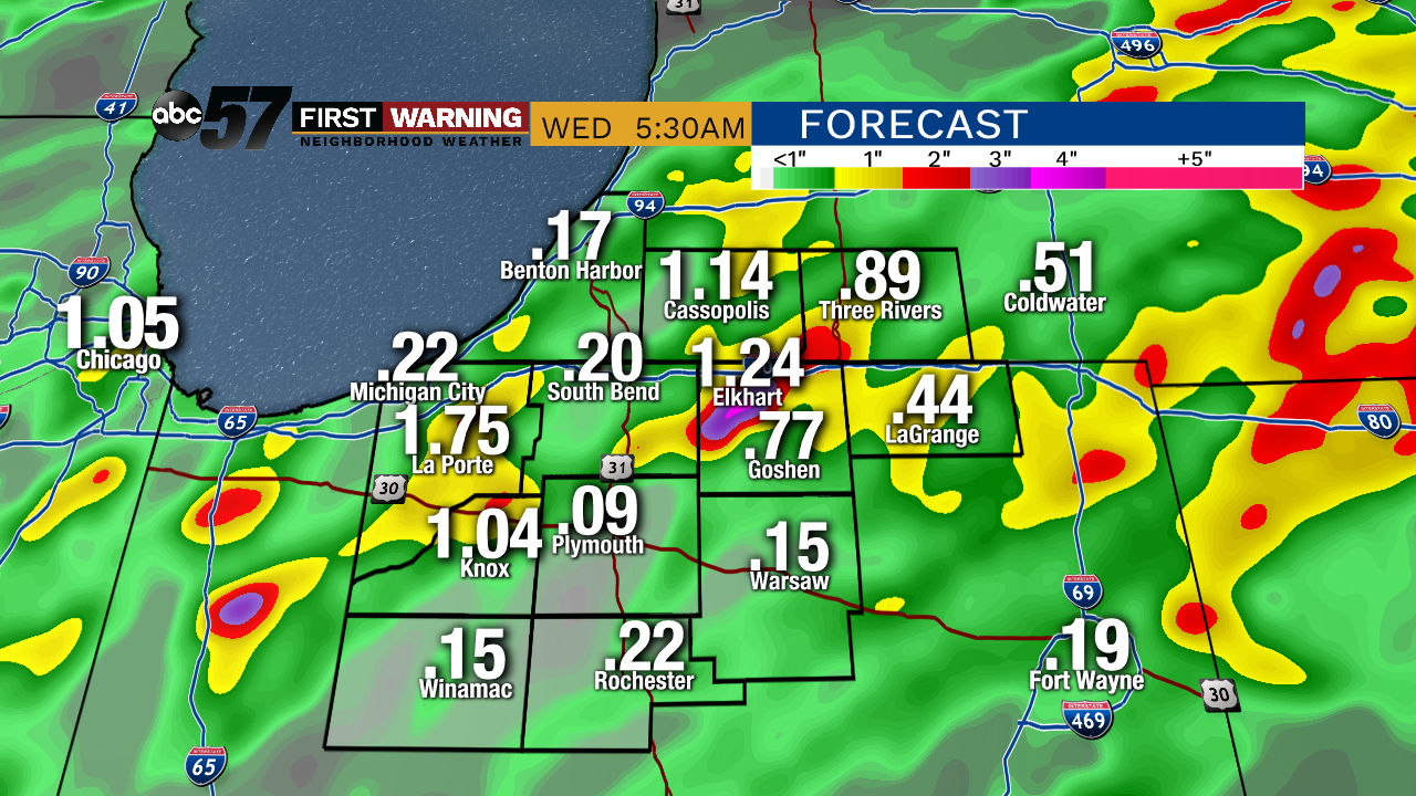
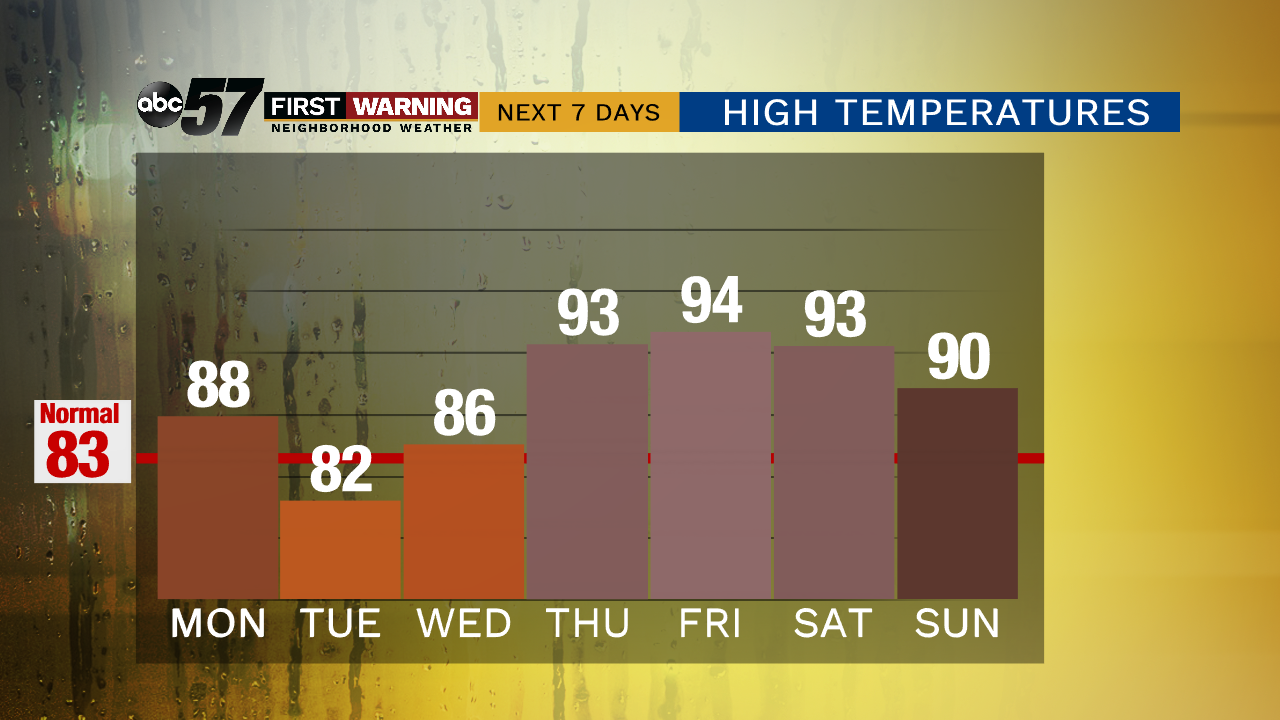
The remnants of Barry will bring scattered showers and thunderstorms with the potential for tropical downpours, as a surge of humidity also arrives. The heavy rain threat will last through Wednesday morning. As the chance of rain decreases to end the week the sweltering heat will soar. A heat wave, the warmest stretch since August of 2013 will last from Thursday, through the weekend. The combination of heat and humidity will make this stretch dangerous, especially for at risk groups, the very young / old and those with health conditions.
Tonight: Mostly cloudy, chance of rain late, low of 70.
Tuesday: Scattered showers and storms, heavy rain possible, high of 82.
Wednesday: Partly to mostly cloudy, slight chance of a shower, high of 86.
Thursday: Hot and very humid, high of 91.