


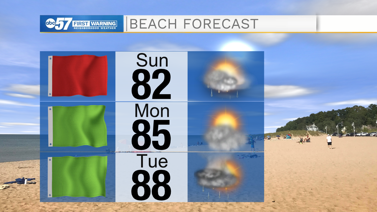
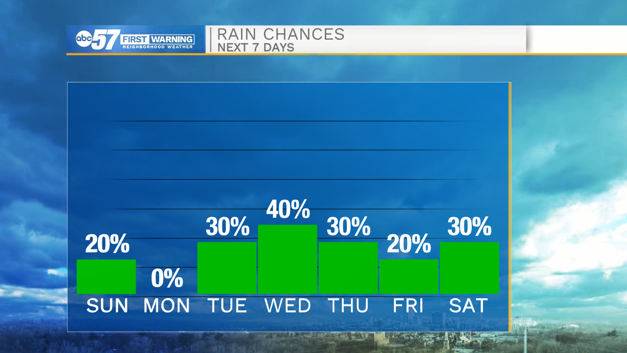
A few isolated showers and storms look to move into Michiana this evening. Most should expect to remain dry as storm activity will be very limited. A few lingering showers are possible into mid-morning tomorrow, but overall Sunday will stay mostly dry with lots of sunshine. High temperatures tomorrow will top out in the mid 80s. If you had plans to head out to the beach tomorrow, stay out of the water. A Red Flag is in place due to stronger winds moving in out of the north, which will increase wave heights. Daily rain and storm chances will remain with us throughout most of next week. Rain chances are on the lower side as activity looks to stay isolated, but everyone will hold a chance for a shower or storm to roll through. High temperatures this week will near 90 degrees on Wednesday, then highs drop back into the lower 80s heading into next weekend.
Tonight: Partly cloudy/isolated showers. Low 68.
Tomorrow: Mostly sunny. High 84.
Monday: Mostly sunny. High 88.
Tuesday: Isolated showers/storms. High 88.