Brief, but intense blast of arctic air eyes Midwest and Great Lakes
SOUTH BEND, Ind. -- Hopefully you don't get to used to the milder weather this weekend because Mother Nature is about to remind us that it can get extremely cold in December.
Our second blast of arctic air is set to arrive Tuesday morning and last through next Thursday night.Daytime highs will be near 30° on Tuesday, near 20° on Wednesday and in the upper 20s next Thursday.
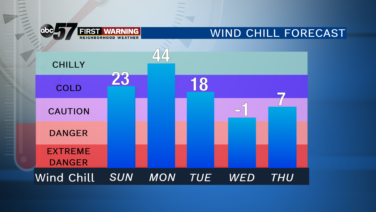
Low temperatures Wednesday morning, Thursday morning and Friday morning will be in the teens, if not the upper single digits in spots.Wind chill temperatures will be even colder during this stretch as northwesterly winds make things feel significantly colder.
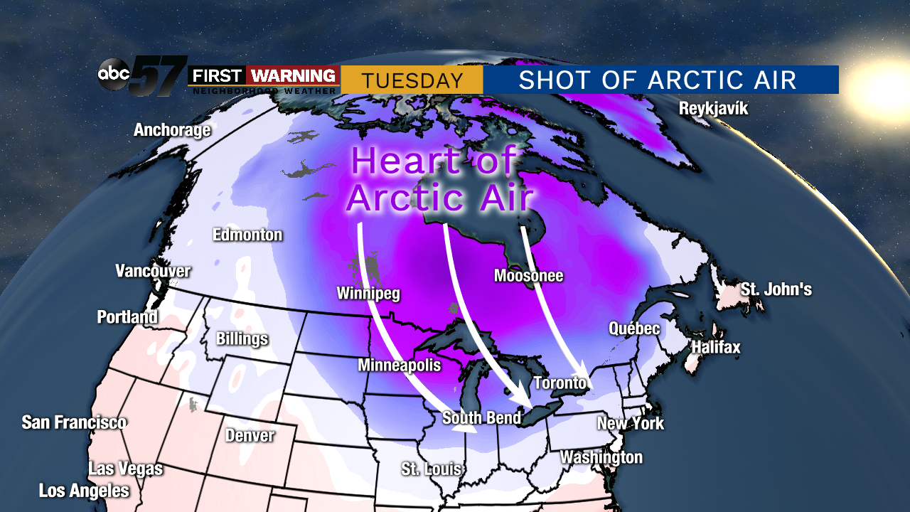
It's courtesy of a powerful cold front expected to slide through Monday night. That will open the door for a quick shot of intense arctic air originating in Northern Canada.
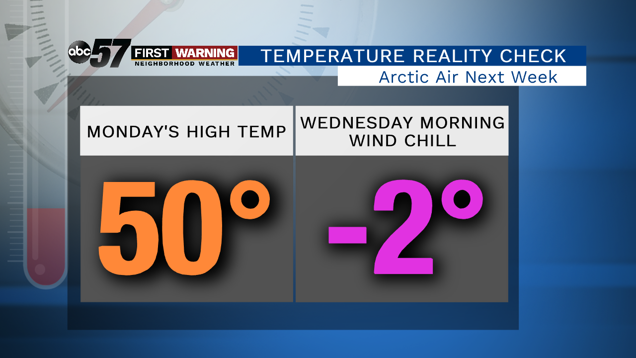
The absolute coldest day will likely be Wednesday. From start to finish it's looking like a very unpleasant day to be outdoors.The day will start in the lower teens with feels like temperatures at or below zero. By the afternoon, we may not even get to 20° with feels like temperatures remaining in the single digits and lower teens.
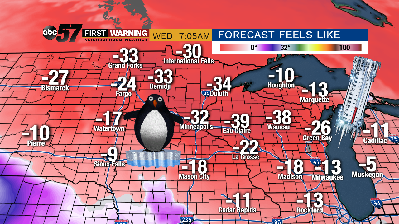
Fortunately, the heart of this arctic air intrusion will stay just to our northwest. Areas as nearby as northern Illinois and southern Wisconsin will see feels like temps down in the -10° to -20° range.If you head a little farther north than that you'll run into feels like temps as cold as -20° to -40° in parts of Wisconsin, Minnesota and North Dakota.
As mentioned, the truly arctic air will not last long. By next Friday we are expecting temperatures to top out near 40° once again.


