


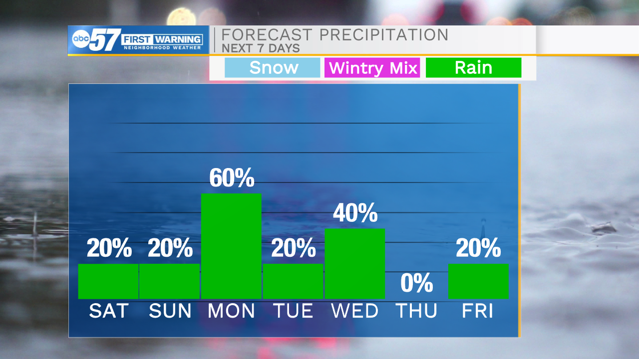
This morning we are tracking clear skies with cooler temperatures. We will heat things up fast heading into the afternoon with highs hitting the mid 70s. Cloud cover will slowly increase throughout the day as well. A few isolated showers can’t be ruled out in far northern Michiana during the afternoon and evening. Cloud cover will remain in place throughout Sunday, but high temperatures will still reach into the upper 70s to lower 80s. A stray shower or two can’t be ruled out tomorrow afternoon as well. Our next best chance for scattered showers will arrive Monday morning and linger into the afternoon and evening. High temperatures as we start the work week will hold in the low to mid 70s. More rain chances return on Wednesday, but then dry weather makes its way back into the forecast for next weekend.

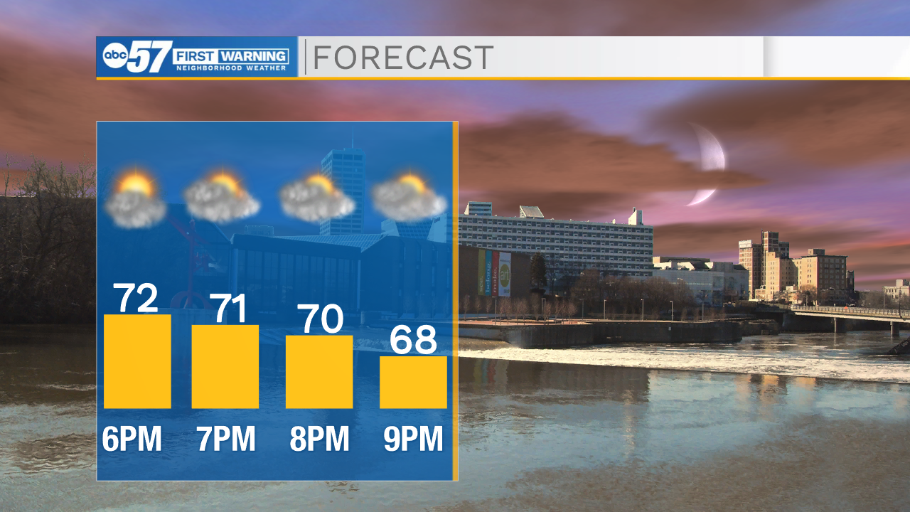
Today: Mostly sunny/partly cloudy. High 74.
Tonight: Mostly cloudy. Low 58.
Tomorrow: Mostly cloudy. High 80.
Monday: Scattered showers. High 76.