


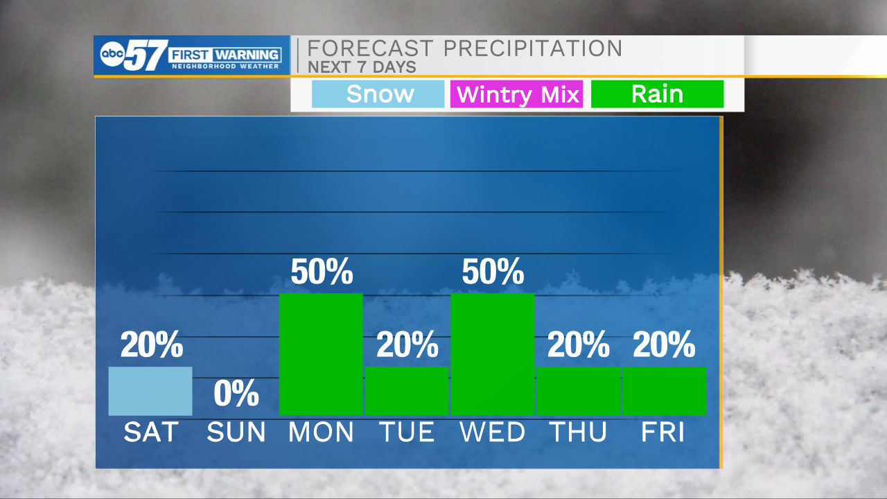
This morning we are tracking a few snow showers for portions of Michiana. This snow is still very low impact as air temperatures are at or just above freezing. Most snow accumulation will develop on elevated surfaces, as ground temperatures are still too warm to support widespread accumulation. Watch for a few isolated slick spots on bridges and overpasses. Snow will move out later this morning, but cloud cover remains in the forecast. Highs today will only top out in the lower 40s. Later this evening, cloud cover will begin to move out, giving way to clearer skies heading into Sunday. Sunday will be a beautiful day to get out and enjoy some sunshine. Highs will push into the upper 50s. Our next round of rain arrives Sunday night into Monday morning. Low rain chances remain in the forecast for every day next week. Even a few isolated storm chances look possible heading into next Tuesday and Wednesday. Temperatures will make a run for the 70s Tuesday and Wednesday, but then another cool down will drop highs back into the 50s and 60s for later in the week.
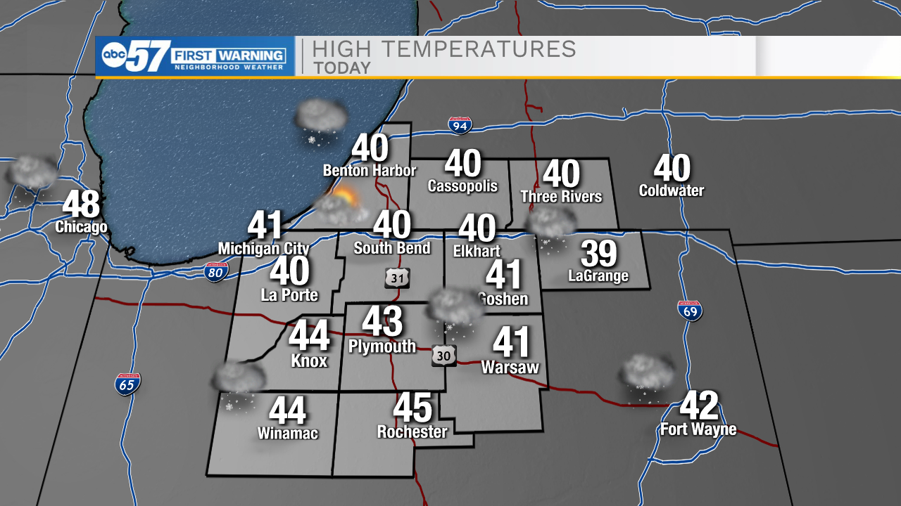

Today: AM snow shower. High 40.
Tonight: Partly cloudy. Low 30.
Tomorrow: Mostly sunny. High 57.
Monday: Scattered showers. High 66.