
-
1:50

Top Ten Snow Year 2025-26
-
1:17

South Bend Cubs unveil fan-focused upgrades ahead of Opening...
-
2:21

Notre Dame Fighting Irish ready for spring football
-
2:06

Fighting Irish using time off to refocus ahead of spring practice
-
2:35

What are the privacy implications of SBPD’s ’Drone as First...
-
1:22

Expert discusses Wednesday’s Fed decision
-
3:19

New legislation could make Michigan the 30th constitutional carry...
-
2:15

SBPD using drones to help improve response time
-
1:20

The March roller coaster ride continues
-
1:52

Snow today, rain tomorrow, and warm this weekend
-
0:49

Celebrating St. Patrick’s Day at Corby’s Irish Pub
-
1:58

The Free Market promotes sustainable shopping

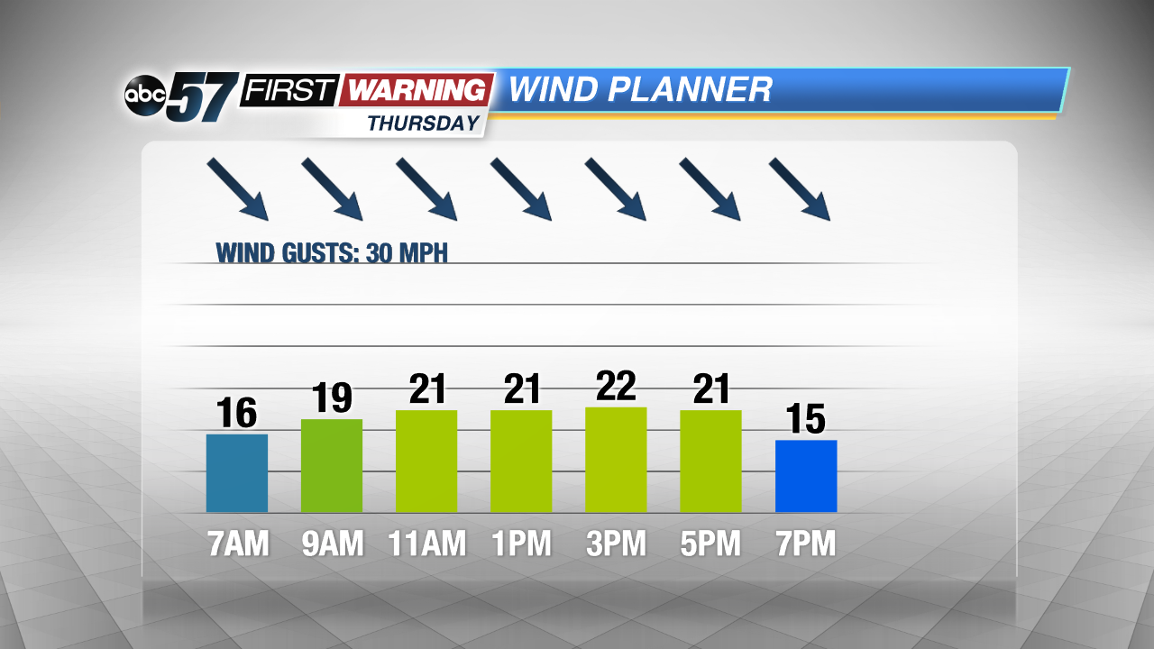
Cold weather ends the week, a few snow showers but little accumulation. Highs Thursday and Friday will struggle to break the freezing mark. The wind might be the biggest factor Thursday, as gusts could top 30 mph, another blustery day. The weekend begins to show some signs of milder weather, a slow but steady warm-up will continue through next week.
Tonight: Mostly cloudy, flurries, low of 24.
Thursday: Mostly cloudy and blustery, chance of snow, high of 30.
Friday: Partly to mostly sunny, highs of 34.
Saturday: Mostly sunny, highs in the low 40s.
Sign up for the ABC 57 Newsletter