Cold and windy today then a mild and sunny weekend

-
2:27

Why Aneyas Williams turned down the transfer portal and stayed...
-
2:21

Bourbon community rallies around Triton boys’ basketball team...
-
5:02

Dave Matthews shares details about LLC bankruptcy filings
-
1:00

Warming up this weekend before more storms next week
-
1:46

A chilly and calm start to the weekend
-
1:00

NIPSCO workers rally in South Bend for new contract
-
1:53

Severe weather threat is over, MUCH colder Friday
-
3:43

South Bend Mayor James Mueller delivers 2026 State of the City...
-
0:52

Family and friends of Adrian Cruz voice frustration in sentencing...
-
2:13

Potawatomi Zoo prepares for opening day with new attractions
-
2:54

Local expert weighs in on landmark social media trials
-
1:33

Round one of storms moving east, Round two arriving soon

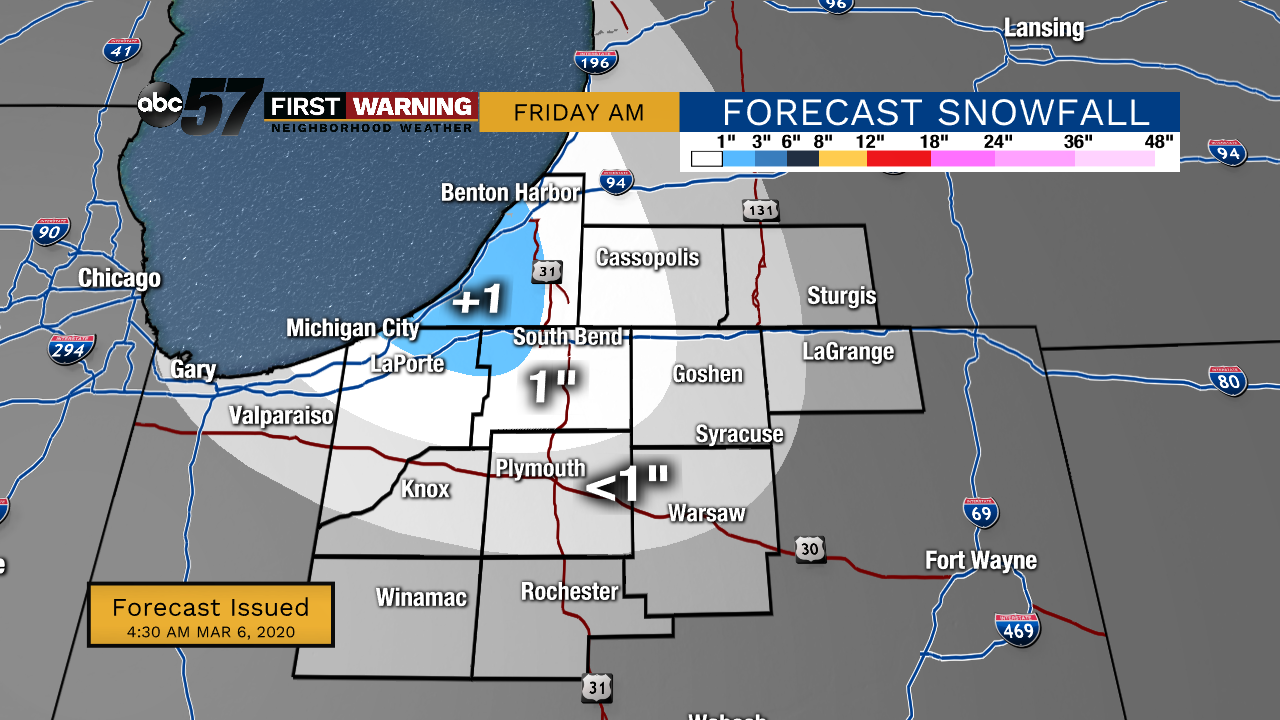
Friday, March 6th, 2020
Snow showers have started this morning and will wrap up early this afternoon. Many will see less than an inch but our northwest counties may see 1-2”. It is cold and windy with a high of only 36 degrees. Due to the high wind, Lakeshore Flood Warning and Wind Advisory is posted for Berrien and LaPorte counties. Wave heights are expected to be 12-16 ft causing more beach erosion.
Thankfully, we quickly warm up over the weekend. It reaches the upper 40s for Saturday and near 60F on Sunday! Plenty of sunshine expected both days. Rain moves in on Monday, starting out the new work week on a soggy note.
Today: Morning snow, windy, and mostly cloudy. High 36.
Tonight: Clearing skies. Low 22.
Saturday: Sunny. High 48.
Sunday: Mostly sunny. High 58.