
-
3:49

Asking for Accountability: Michiana Elected Officials on on-going...
-
3:37

South Bend Cubs explain weekend washout
-
4:02

Early voting is underway as Indiana prepare for its May 5 primary...
-
3:27

Tax-related scams to watch out for
-
0:09

Crews repair weekend washout under Coloma train track
-
0:58

Chilly and sunny Tuesday ahead
-
0:41

Elkhart police investigating Monday night shooting
-
3:47

Elkhart Police Department accepting applications to Citizens...
-
0:52

A slight warm-up but chilly weather still dominates
-
1:09

Bitterly cold out the door
-
3:03

Looking to younger generations to keep Dyngus Day thriving
-
3:06

Even as rivers recede, Marshall County still dealing with flooding

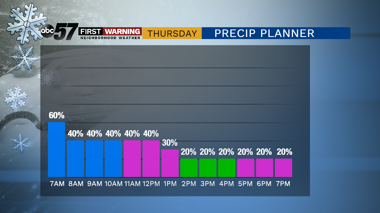
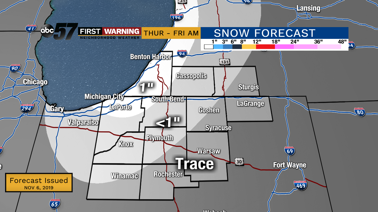
Highs will struggle to break the freezing mark Thursday and Friday. Lake effect snow showers will be mostly confined to Berrien and La Porte counties, even then most will see less than an inch. There’s a short reprieve from the cold this weekend, then another cold blast next week. Round two could flirt with record cold and bring more significant lake effect snow.
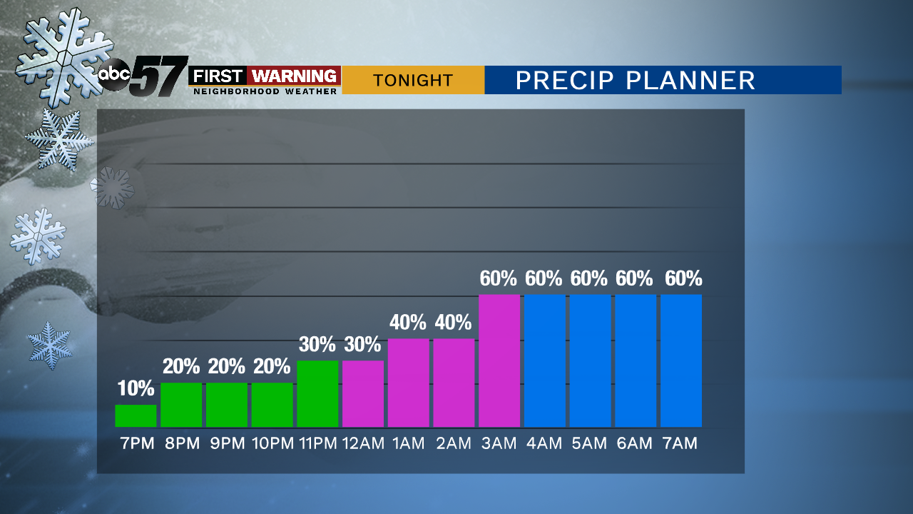
Tonight: Mostly cloudy with rain/snow showers. Low of 30.
Thursday: Mostly cloudy lake effect snow showers. High of 34.
Friday: Partly to mostly sunny. High of 34.
Saturday: Partly cloudy High of 42.
Sunday: Mostly cloudy, PM showers. High of 44.
Sign up for the ABC 57 Newsletter