Cold temperatures and snow chances remain in the forecast


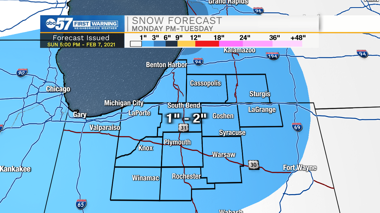
Tonight a few snow flurries and light snow showers are possible, with little to no accumulation expected. Temperatures tomorrow morning will drop into the single digits. More light snow showers will develop tomorrow afternoon and stick with us through the overnight into Tuesday. Right now, 1-2 inches is expected for most places here in Michiana by Tuesday morning. High temperatures Tuesday afternoon will be around 20 degrees. Another round of light snow is possible on Wednesday. A surge of more cold air will move into Michiana by late week and weekend, dropping low temperatures to around 0 and highs in the low teens to single digits.
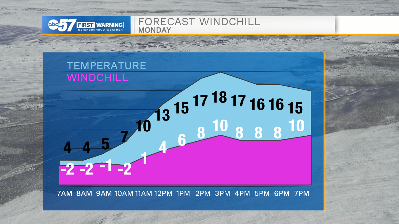
Tonight: Mostly cloudy. Low 4.
Tomorrow: Flurries/light snow showers. High 18.
Tuesday: AM Snow showers. High 20.
Wednesday: Snow showers. High 18.