Cold temperatures in store for the start of your Monday


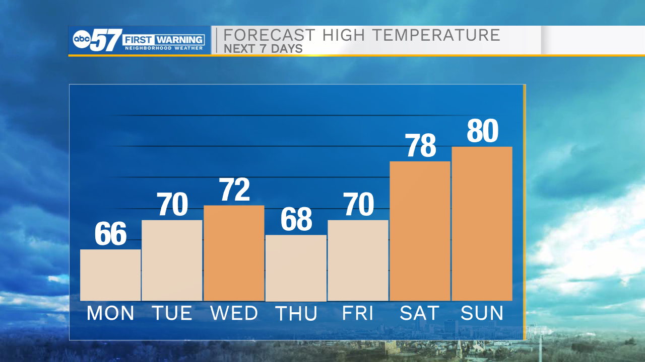
It will be a cool but quiet evening throughout Michiana with temperatures widely in the 50s. Tonight temperatures will drop all the way into the low to mid 40s, so bundle up before heading out the door tomorrow morning. Tomorrow afternoon highs will hit the mid 60s under mostly sunny skies. The dry weather will continue into Tuesday with some slight cloud cover returning. Rain chances return to the forecast Tuesday night/early Wednesday morning. Showers will turn scattered throughout the day with a few thunderstorms possible as well. Rain and storm chances will remain in the forecast for Thursday. Mostly dry weather is expected for Friday and Memorial Day weekend, although a stray shower or two can’t be ruled out Saturday afternoon. We will see another surge of heat into next weekend as well with highs pushing into the upper 70s to lower 80s.
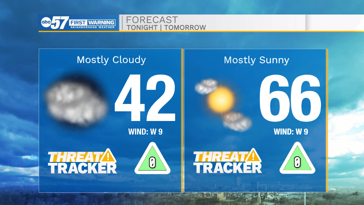

Tonight: Partly cloudy. Low 42.
Tomorrow: Mostly sunny. High 66.
Tuesday: Partly cloudy. High 70.
Wednesday: Scattered showers. High 72.