Cold today but warming up with a messy system this weekend

-
0:46

Crowds gather for Fins and Feathers Fest at La Porte City Fairgrounds
-
0:46

Paramount School of Excellence hosts teacher fair
-
2:30

Voting advocacy, peaceful demonstrations and donations: South...
-
2:04

Warming to start the week, Showers and storms by Tuesday
-
2:10

Cool, but calm, today
-
1:23

City of South Bend presents an ’Age-Friendly Plan’ to better...
-
0:54

South Bend Venues Parks and Arts hosts ’Adult Recess’
-
2:27

Why Aneyas Williams turned down the transfer portal and stayed...
-
2:21

Bourbon community rallies around Triton boys’ basketball team...
-
5:02

Dave Matthews shares details about LLC bankruptcy filings
-
1:00

Warming up this weekend before more storms next week
-
1:46

A chilly and calm start to the weekend

Wednesday, January 8th, 2020
Everyone is colder today as temperatures stay below freezing behind the cold front. That has created light lake effect that will wrap up late afternoon.
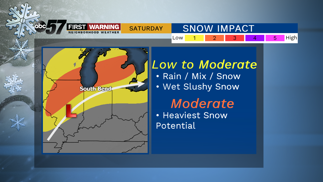
Temperatures rise into the 40s for Thursday and Friday, along with rain showers moving into the region. For Friday, we are going to be right on the cusp of the cold and warm air. So far, it looks like the warm air keeps it rain for Friday, then turning into a wintry mix overnight. That then transitions into mix and snow Saturday but how much snow we see will be dependent on how quickly the cold air moves into our area.
Today: Mostly cloudy. High of 28.
Tonight: Few clouds. Low of 22.
Thursday: Mostly cloudy, PM rain. High of 46.
Friday: Scattered rain showers. High of 50.