


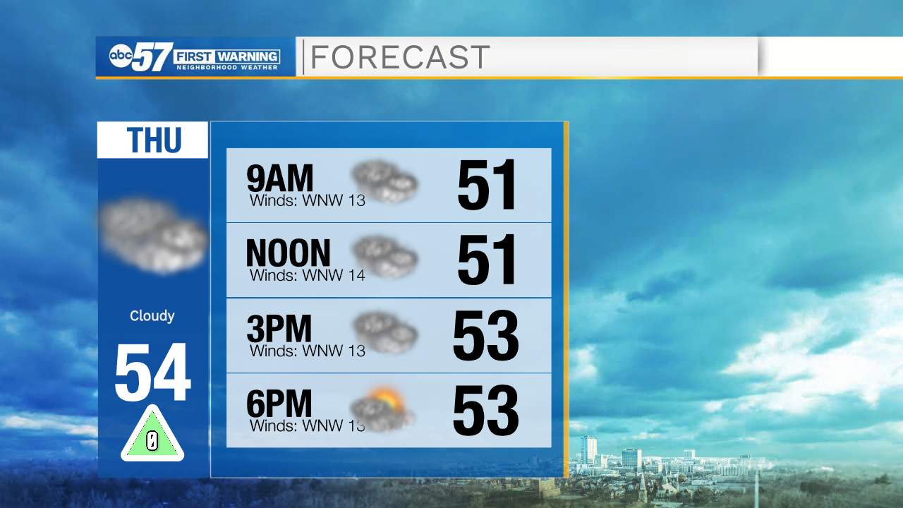
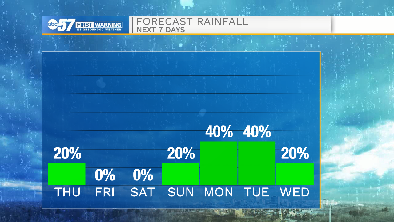
A cold front will move through Michiana this morning bringing a few chances for light rain showers and drizzle. After the front clears to the east, rain activity will move out as well. Temperatures will stay in the 50s for most of the day. Tonight, some cloud cover will clear out and temperatures will drop into the mid 30s. Frost looks likely for tomorrow morning. High temperatures tomorrow afternoon will be in the mid 50s. Low rain chances are in the forecast for tomorrow afternoon and evening as a few isolated showers are possible.
This weekend high temperatures will stay in the mid to upper 50s. More rain chances return Saturday night through the middle part of next week. Right now the best chances for rain here in Michiana look to arrive Tuesday and Wednesday. High temperatures next week will slowly warm back into the mid 60s by Wednesday afternoon.
Today: Cloudy. High 54.
Tonight: Partly cloudy. Low 35.
Tomorrow: Partly cloudy. High 56.
Saturday: Mostly cloudy. High 58.