
-
2:15

Severe weather likely for portions of Michiana later today
-
2:34

Open House for a new pedestrian bridge leaves Riverside Residents...
-
2:16

Notre Dame’s CJ Carr embraces growing expectations while leading...
-
2:34

Injuries sideline key linebackers as Notre Dame leans on depth...
-
0:58

U.S. Army increases maximum enlistment age from 35 to 42
-
2:08

Large hail, damaging winds and tornadoes possible Thursday
-
1:40

Nicholas Stanley appears in court, prosecutors push to prevent...
-
3:18

Expert breaks down high gas prices and factors impacting price...
-
2:08

Westview community rallies around boys’ basketball team headed...
-
2:06

The threat for severe weather has increased
-
2:16

More sunshine today with a severe risk tomorrow
-
0:32

Granger residents share input on proposed S.R. 23 roundabout

Very cold start to Saturday, temperatures begin a slow but gradual warm-up into next week. Saturday is dry but Saturday night into Sunday a system will bring a rain/snow mix, changing to mostly rain by Sunday afternoon. Sunday is dreary, Monday is sunny and next week is milder with highs in the 50s.
Tonight: Mostly clear to partly cloudy, low 18.
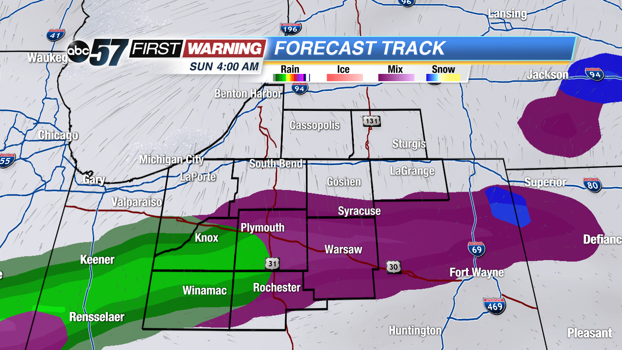 Rain/Snow mix early Sunday morning
Saturday: Partly cloudy, high 38.
Sunday: Rain/snow mix changing to rain, highs in the low 40s.
Monday: Mostly sunny, highs in the mid-40s.
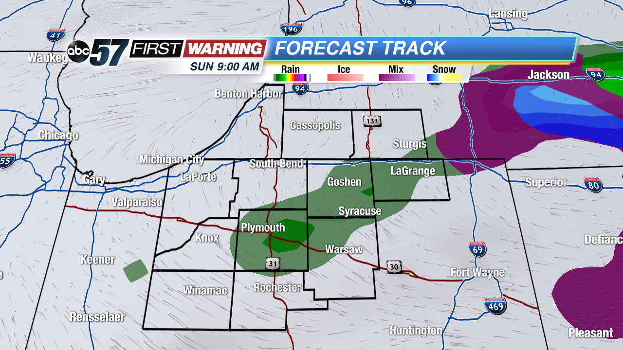 Precip changes to mostly rain/drizzle by mid morning Sunday
Sign up for the ABC 57 Newsletter