
-
2:28

Kicking off day two of the Gus Macker Basketball Tournament
-
0:50

Beautiful weekend starts this morning
-
2:32

Gus Macker Three-on-Three Basketball Tournament is taking over...
-
1:44

Feeling like a sauna next week
-
3:12

How to keep yourself and others protected during firework season
-
0:49

Showers creeping into Michiana
-
1:32

Judge approves $25 million water lawsuit settlement in Benton...
-
1:00

Scattered showers through the day
-
1:53

Hispanic Community Child Safety Meeting: A Call To Action
-
2:51

Obama Presidential Center features work of South Bend company
-
1:54

This week’s ABC57 Cub Reporter is Isaac Knefely
-
1:16

Real summer heat returns next week

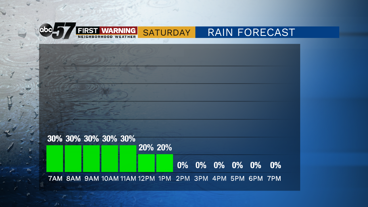
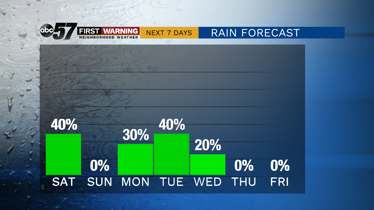
The technical high for Saturday may come just after midnight as temperature fall from 50 into the morning. A cold front cuts through area area early Saturday and temps fall from the upper-40s to the low 40s by afternoon. A few spotty rain showers and drizzle last through midday. The cool and dreary weather quickly exits and Sunday is fair and mild. Monday and Tuesday is the next chance of rain with scattered thunderstorms.
Tonight: Mostly cloudy. Low of 46.
Saturday: Spotty rain / drizzle. Falling from 46.
Sunday: Mostly sunny. High of 57.
Monday: Mostly cloudy, chance of rain. High of 64.
Sign up for the ABC 57 Newsletter