


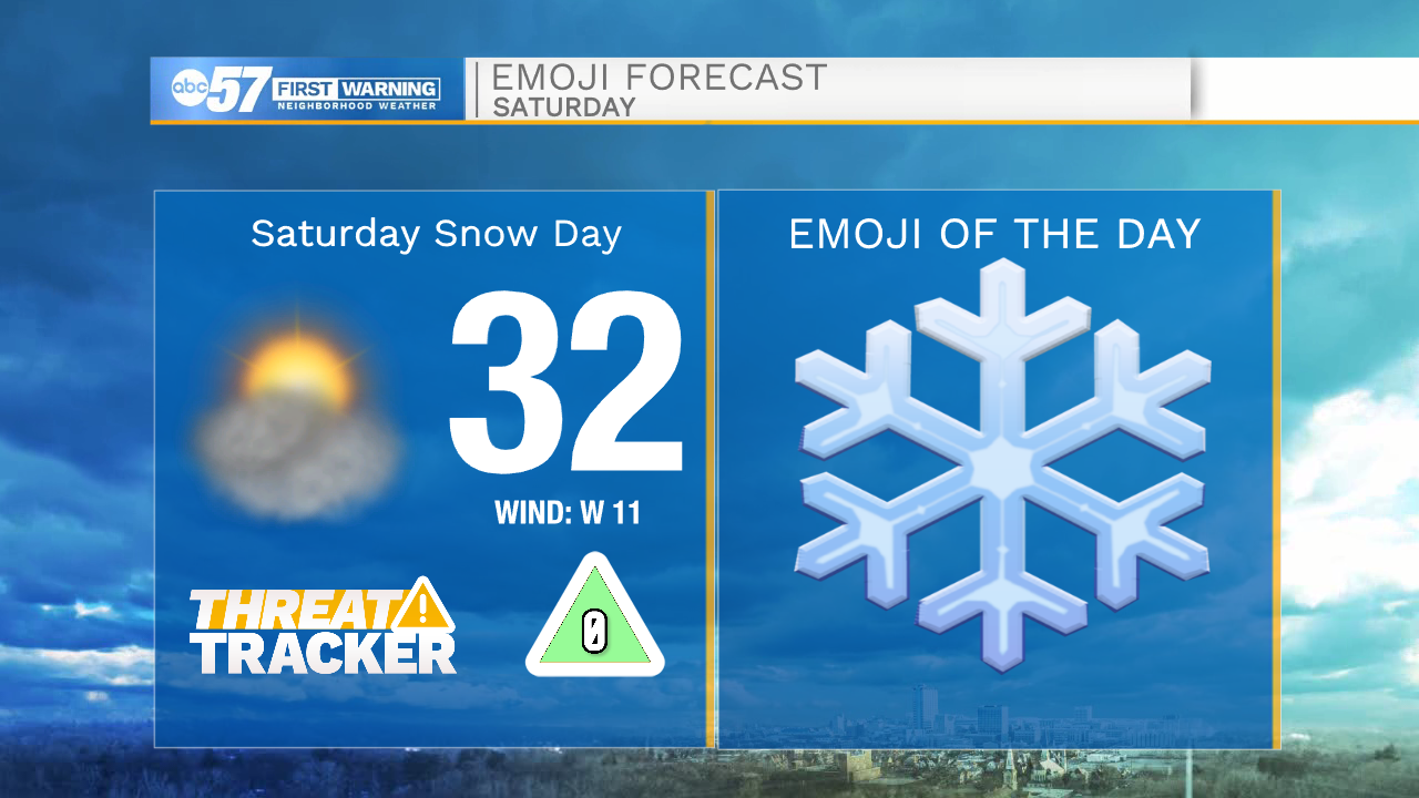
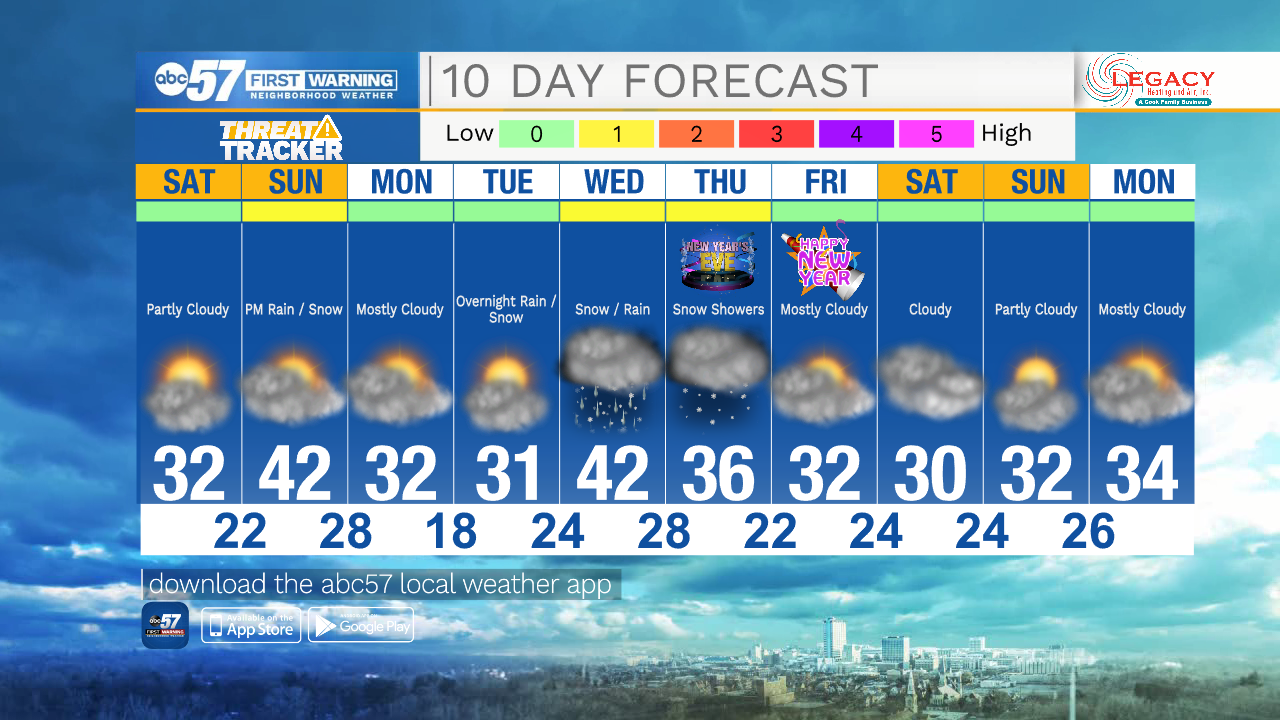
After the excitement of the snow and holidays, Saturday's forecast is going to seem a little more quiet. No new snow is expected today. Temperatures will still be cool today, but won't feel as miserable as the last few days. We'll reach a high around 32 this afternoon.
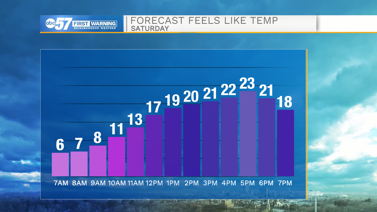
It's still breezy today, so feels like temperatures are cooler than actual temperatures again.
Skies are partly cloudy to mostly sunny. Overnight stays partly cloudy with a low in the low 20s.
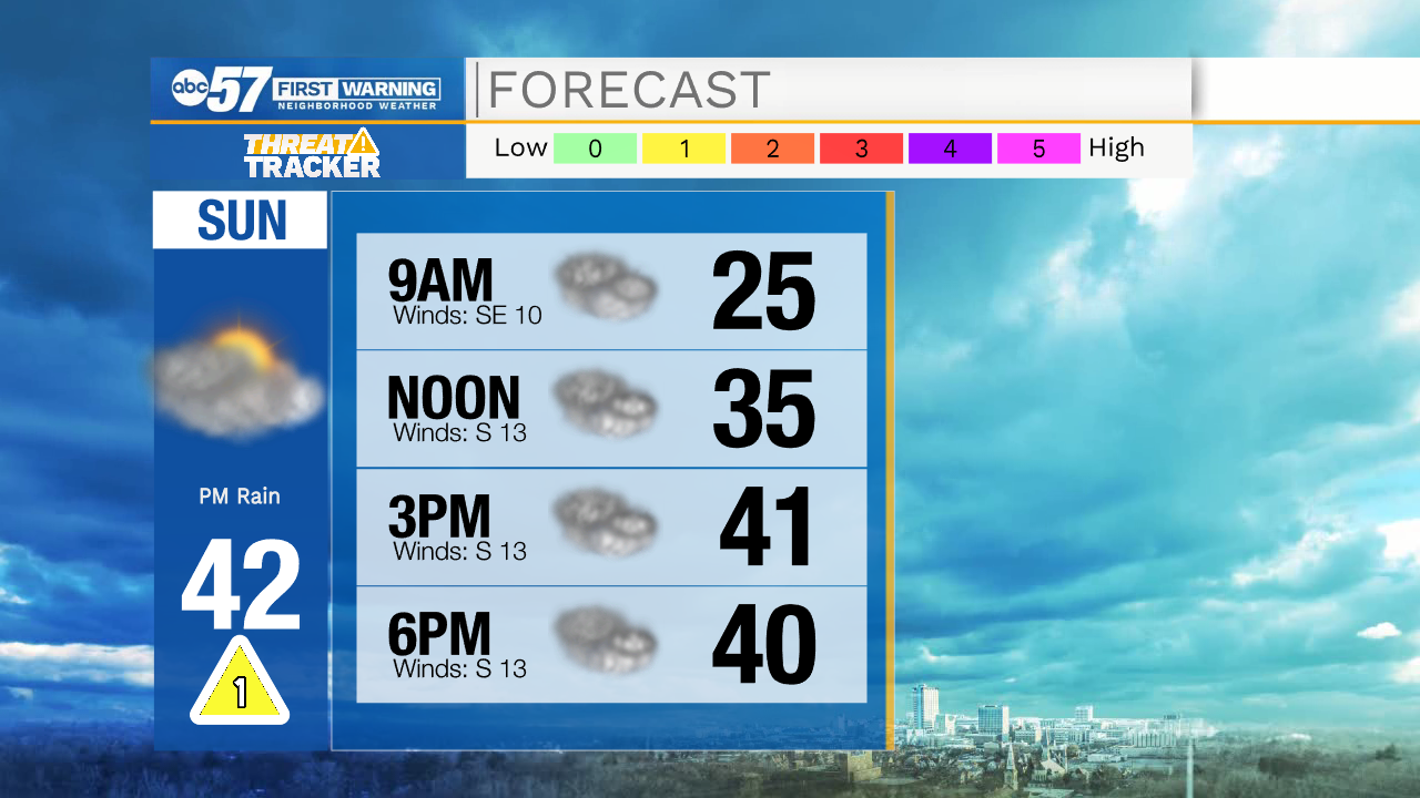
Most of Sunday is dry, and temperatures are nice for this time of year with a high in the low 40s. Sunday evening there is a chance for a few rain showers. Sunday overnight rain will turn into light snow showers or flurries, with a possibility of a freezing drizzle.
Roads could be slippery Monday morning, then it is quiet again Monday and Tuesday. The next system we are tracking is Wednesday which will bring rain and snow chances.
Today: Partly cloudy. High 32.
Tonight: Partly cloudy. Low 22.
Sunday: Cloudy. Chance for rain showers by evening, then light snow overnight. High 42.
Monday: A chance of flurries or snow showers in the morning, then cloudy. High 32.