
-
3:08

Officials recover body of missing teenager in Lake Michigan off...
-
2:45

NCAA’s new eligibility rule could reshape Notre Dame roster...
-
1:08

Storms start this afternoon
-
0:56

Calm morning, storms tonight
-
2:43

South Bend residents see future plans for former Drewry’s Brewery
-
2:45

Damage assessment continues in Elkhart County following EF-2...
-
0:44

Indiana and Illinois set record for tornadoes
-
1:27

Community Build underway at Kathryn Park
-
2:34

Day two of searching for a missing child continues
-
3:47

The Elkhart community is searching for answers after a 2-year-old...
-
1:04

Overall pleasant for Michiana
-
1:52

South Bend Common Council issues an official apology to residents...

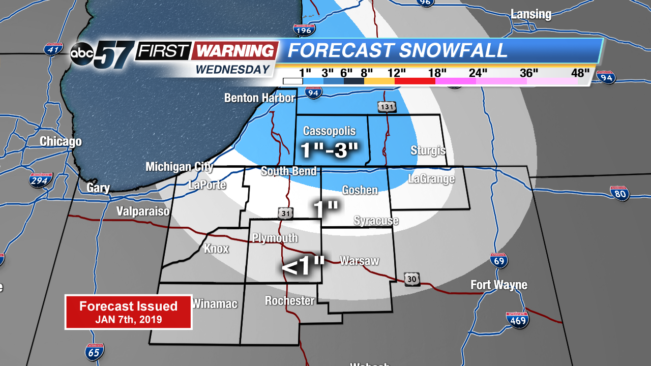
Dreary, rainy and breezy weather continues Tuesday, with temperatures still holding above 40. The drop will come Tuesday night, through Wednesday in the wake of another cold front. Lake effect snow showers develop and last through Thursday morning. An area of one to three inches is possible in the lake effect snow zones. Temperatures trend colder than how the month started but low 30s are typical for mid-January.
Tonight: Chance of rain showers, breezy, low of 40.
Tuesday: Cloudy, chance for rain showers, highs in the mid-40s.
Wednesday: Lake effect snow, cloudy. High of 26.
Thursday: Morning snow showers, high of 28.
Sign up for the ABC 57 Newsletter