


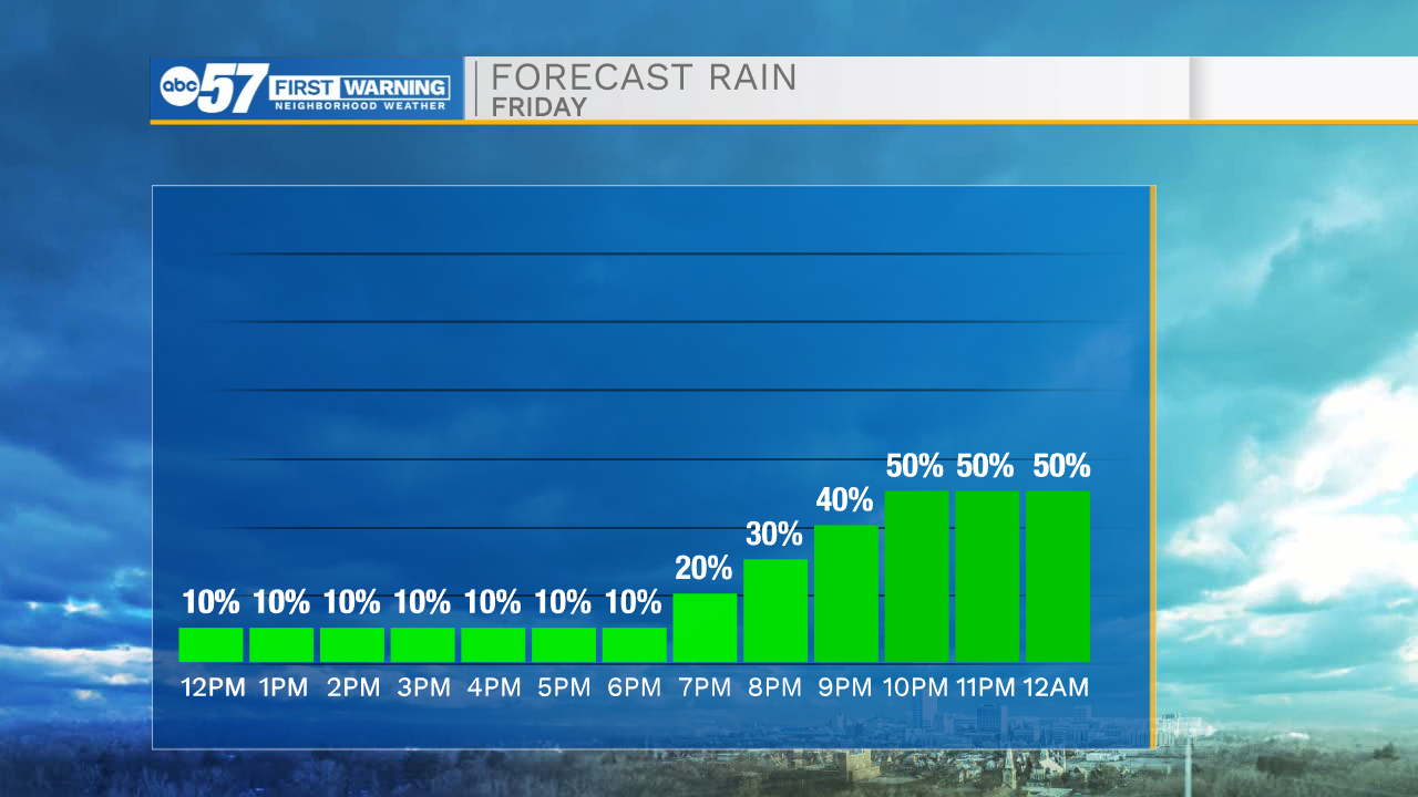
Friday is warm, humid, and breezy, and most of the day stays dry. The rain and storms will start late tonight, and we still need to stay weather aware.
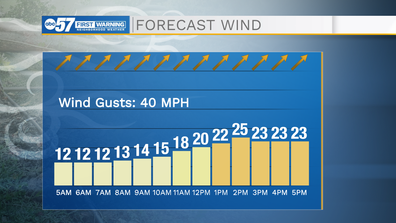
Wind could gust up to 40 mph this afternoon, so make sure your patio furniture and trash cans are secure.
Late tonight, we’ll see rain showers and thunderstorms. There's still the potential that some of these storms could be strong, possibly severe. The biggest impact is likely downpours/periods of heavy rain. The overall threat of severe weather in the tonight/tomorrow time period is lower than in previous forecasts.
This is going to lead into a wet day Saturday. It will rain most of tomorrow, along with a few more thunderstorms.
After the front passes, we should be dry by Sunday but cooler with highs in the low 60s.
Temperatures will bounce back near normal levels (around the 70 degree mark) next week.
Today: Partly cloudy and breezy. PM thunderstorms. High 88.
Tonight: Rain and thunderstorms. Low 60.
Saturday: Rounds of rain and thunderstorms. High 70.
Sunday: Mostly cloudy and cooler. High 62.