


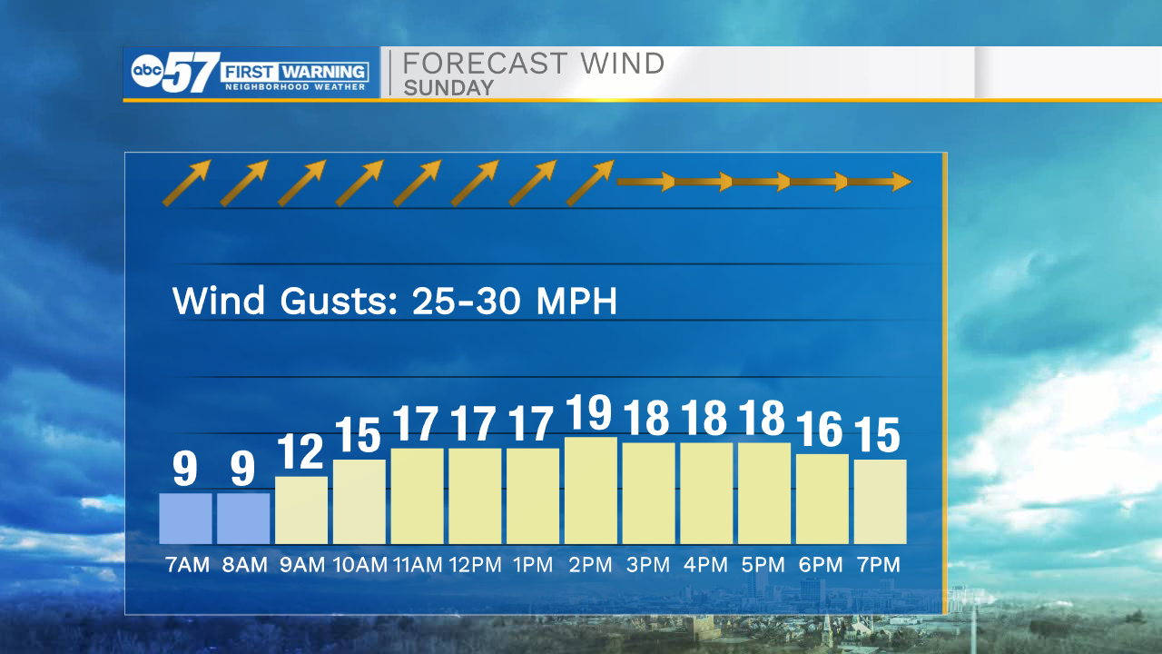
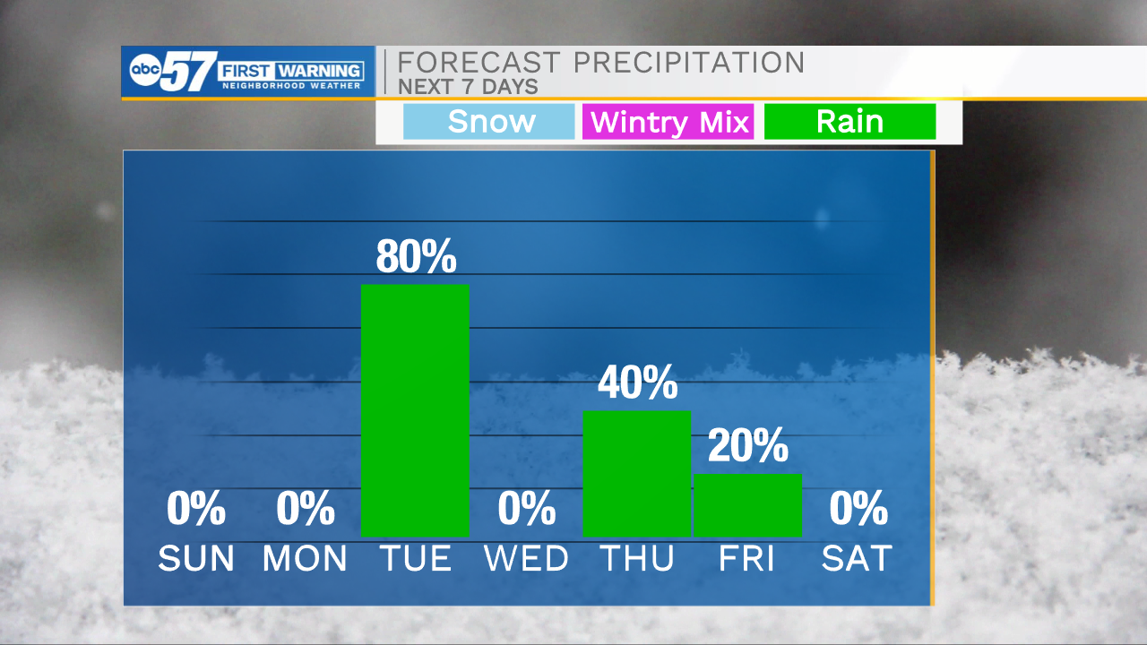
This morning temperatures are in the 50s under partly cloudy skies. We will see some sunshine through mid to late morning, but then cloud cover is quick to return. This cloud cover will only allow temperatures to hit the upper 50s to lower 60s for highs. Winds will again be on the breezy side today. Tomorrow will remain mostly dry as well with some clearing during the morning and cloud cover during the afternoon. Highs for Monday will be in the lower 60s. Rain showers return to the forecast around midnight tomorrow, and will stick around throughout all of Tuesday. We will catch another dry day Wednesday before more showers return to the forecast for Thursday. Those showers will linger into Friday afternoon and evening. Next weekend looks mostly dry with low rain chances returning for Mother’s Day. High temperatures this week will mostly remain in the 60s.
Today: Partly/mostly cloudy. High 62.
Tonight: Mostly cloudy. Low 46.
Tomorrow: Partly/mostly cloudy. High 62.
Tuesday: Scattered showers. High 66.