Enjoy one more warm day before cooling trend this week
By: Maci Tetrick
Posted: May 3, 2020 6:07 AM EDT

-
1:27

Updated Tornado Survey- June 1, 2026
-
1:13

Severe Weather possible midweek
-
1:07

Quiet Monday, Stormy Midweek
-
2:52

GhostLight Theater presents Next to Normal Performance for Benton...
-
2:40

Car Show raises funds for Deputy Jon Samuelson
-
0:47

Nappanee became Candyland Saturday
-
2:01

The Juneteenth Cultural Alliance hosts Juneteenth celebrations...
-
1:11

Morning rain, breezy afternoon
-
0:53

Showers out the door
-
0:38

Two injured in overnight shooting
-
2:52

Cleanup efforts continue in Kouts after EF-3 Tornado
-
2:04

Michiana PrideFest celebrates its 5th year with a sports theme

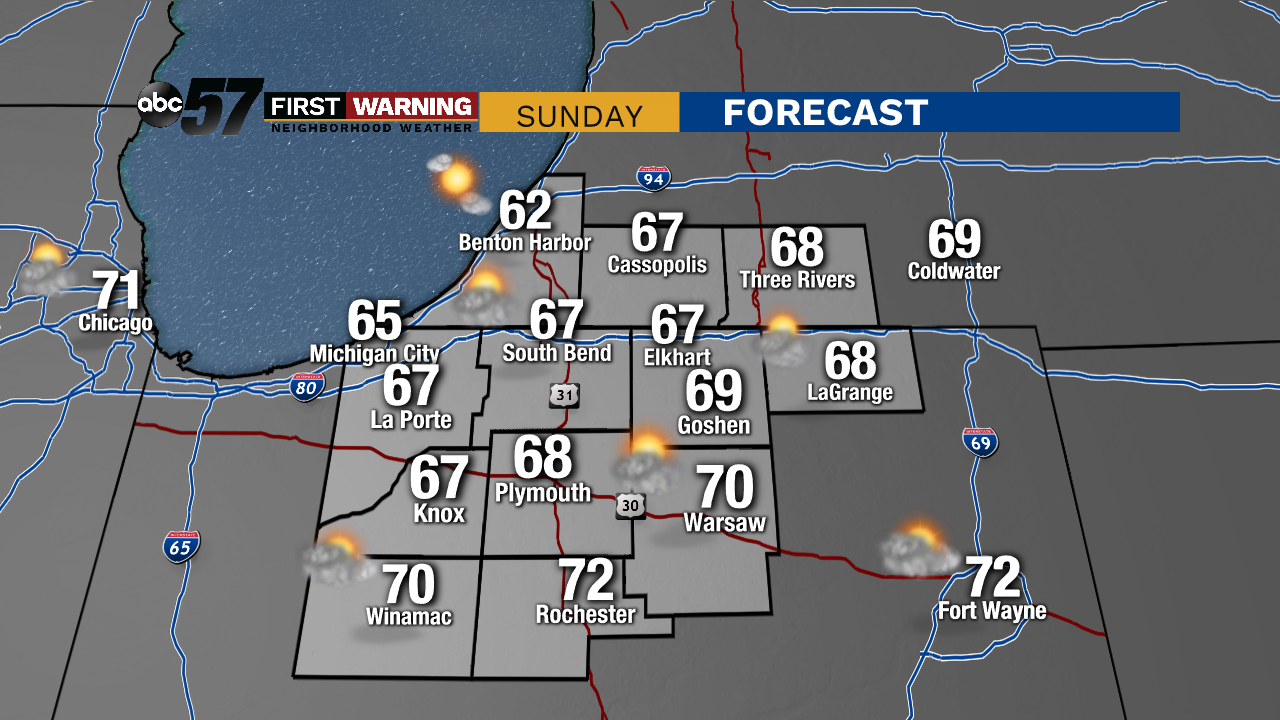
A quiet end to the weekend. Although Sunday won't be quite as warm as yesterday, the day stays dry and partly sunny. Highs will be in the upper 60s this afternoon.
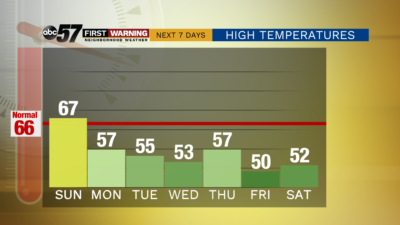
Enjoy this pleasant day-- another cold front moves in later tonight which will drop temperatures for the work week. Tonight is mostly clear with a low near 40.
Monday's high is in the upper 50s. It is mostly sunny on Monday before overnight rain chances. Scattered showers continue Tuesday and early Wednesday morning. Temperatures stay cooler than normal, in the low to mid 50s for the rest of the week.
Today: Partly sunny. High 67.
Tonight: Mostly clear. Low 40.
Monday: Mostly sunny. Showers overnight. High 57.
Tuesday: Overcast, scattered showers. High 55.
Sign up for the ABC 57 Newsletter