
-
2:00

A sunny Monday ahead, rainy almost every other day this week
-
2:59

Dusty May leads Michigan back to Final Four with dominant win...
-
0:37

Vendors and cosplayers showcase art at South Bend Anime Fest
-
3:06

Palm Sunday procession in South Bend unites faiths in call to...
-
0:48

2026 Auto Show brings crowd to Century Center Sunday
-
2:34

Warm to start the week, Rainy week ahead
-
2:44

Warmer, breezier, and cloudier than yesterday
-
0:46

Crowds gather for Fins and Feathers Fest at La Porte City Fairgrounds
-
0:46

Paramount School of Excellence hosts teacher fair
-
2:30

Voting advocacy, peaceful demonstrations and donations: South...
-
2:04

Warming to start the week, Showers and storms by Tuesday
-
2:10

Cool, but calm, today

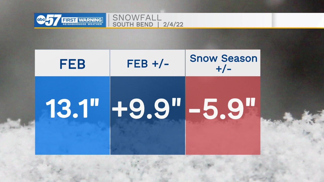
A fair end to the weekend, and slightly warmer. There's a chance of light snow Sunday night into Monday, and there's additional snowfall until the end of next week. Temperatures could break the freezing mark Wednesday before falling again into next weekend. Next Friday will be the next day to watch for widespread measurable snowfall.
Tonight: Mostly clear. Low 12.
Sunday: Partly sunny and not as cold. High 28. Snow showers possible late.
Monday: Mostly cloudy, with a few flurries/snow showers possible. High 26.
Tuesday: Partly cloudy. High 32.
Sign up for the ABC 57 Newsletter