
-
2:06

Staying sunny until Thursday
-
0:58

Goshen City Council amends DORA rules amid community concerns
-
1:20

SB Common Council adopts Downtown 2045 Plan
-
2:39

Friends and family celebrate life of Jamecia Moffitt
-
1:15

St. Joseph County Council updates residents on Affordability...
-
0:51

Locals gather to recognize farmworkers across Northern Indiana
-
2:07

Impact of higher gas prices for delivery drivers
-
3:43

ND Eviction Clinic exposes ’shameful’ living conditions at...
-
3:59

Neighbors share traffic, noise concerns about proposed Capital...
-
1:50

Leaf pick up resumes in South Bend after weather postpones service...
-
1:02

Another rollercoaster ride to end the week
-
3:41

Present Pillars to host “Dad Strong 5K“ to support fathers...

Showers move through Friday evening between 7 PM and midnight, clouds break into Saturday morning.
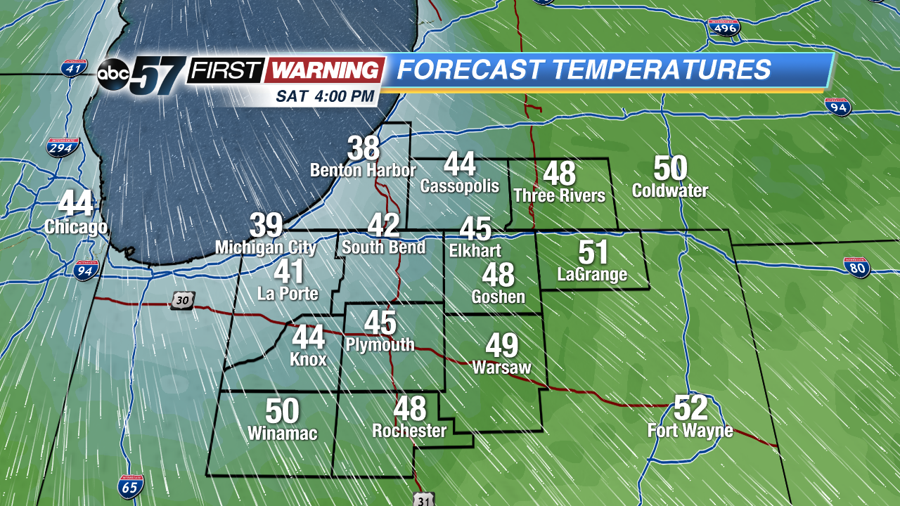
The weekend starts chilly, temperatures will struggle to break 50 on Saturday. A frost/freeze is likely Saturday night as temperatures dip into the upper 20s. Sunday is fair and milder with highs near 60 and high jump into the 70s for most of next week. The best chance of widespread showers and possible storms is still likely next Wednesday and Thursday.
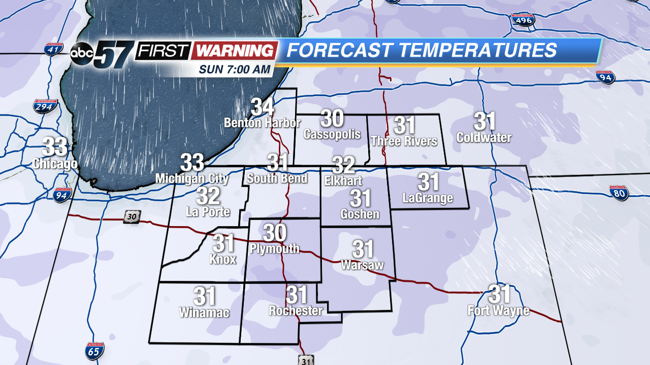
Tonight: Evening showers, low 38
Saturday: Partly cloudy, high of 48.
Sunday: Sunny, high of 58.
Monday: Sunny, highs near 70.
Sign up for the ABC 57 Newsletter