
-
5:17

Quilt and Fiber Experience returns to Elkhart County
-
1:02

Sunny and pleasant Tuesday morning
-
1:40

Elkhart holds annual Memorial Day parade
-
3:37

Law enforcement, veterans and more participate in Back the Blue...
-
3:47

Families honor lost loved ones as lifeguards return to South...
-
1:16

No shortage of sunshine today
-
1:37

Memorial Day parade forecast
-
4:51

Local band ’The Erly’ stops by ABC57 ahead of June 3 performance
-
1:17

VERY foggy first few hours of the morning
-
1:57

A local taste brings New Carlisle community together on race...
-
0:45

Pancakes help raise funds to support the Alzheimer’s Association
-
1:03

Lighter rain expected into the afternoon

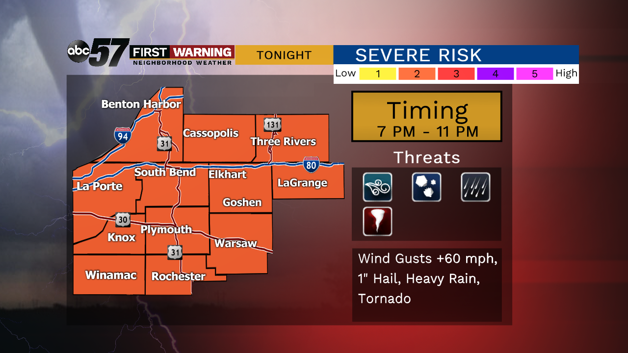
There is a highly conditional severe threat this evening. If temperatures can rise into the 80s by 5:00 p.m. it will boost fuel and the severe potential for storms this evening between 7:00 and 11:00 p.m. The cooler and cloudier it stays the lower the severe threat. All threats are possible, especially damaging wind gusts near strong storms.
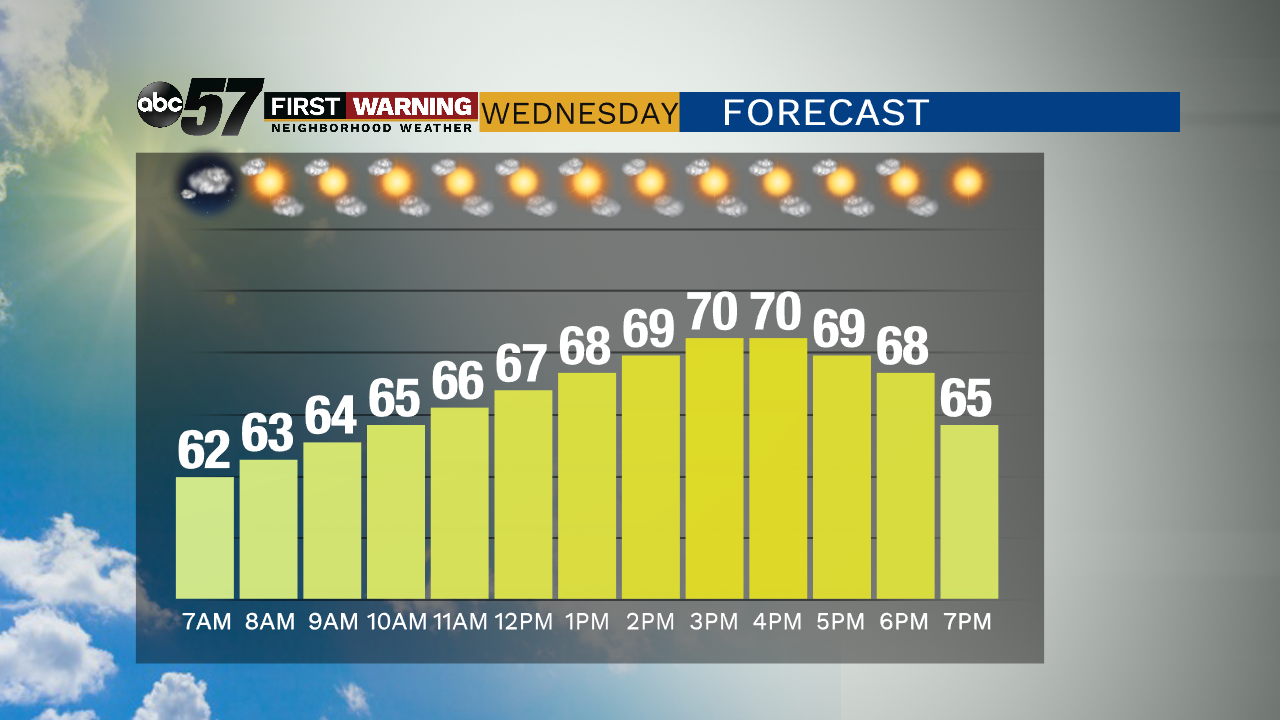
A fall front will make for brisk day for early September as high struggle to reach 70, aided by a cool northwest breeze at 10 to 15 mph. The midweek is fair with sunshine and temps recover to end the week. Mild weather lasts through the weekend.
Tonight: Evening storms, low of 62.
Wednesday: Mostly sunny, breezy, high of 70.
Thursday: Sunny, high of 74.
Friday: Partly cloudy, high of 76.
Sign up for the ABC 57 Newsletter