
-
3:19

Mishawaka apartment resident raises concerns over algae-filled...
-
2:55

USA World Cup watch party at Manny’s Sports Bar
-
3:15

RedBud Nationals brings 4th of July motocross tradition back...
-
1:49

RedBud organizers prepare for high temps at this weekend’s...
-
2:10

Indiana FSSA breaks down report on SNAP error rates
-
2:53

Street camping now illegal across Hoosier state
-
2:37

Preview the possibilities at the St. Joseph County 4H Fair
-
1:17

Local reactions to the Supreme Court’s ruling on transgender...
-
2:32

Local experts and politicians weigh-in on the Supreme Court’s...
-
8:00

250 years of Indiana sports history, a legacy built across generations
-
7:19

Savoring Michiana
-
3:16

Dowagiac residents seek class action over noise from hyperscale...

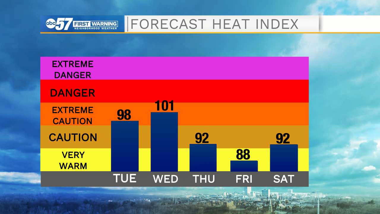
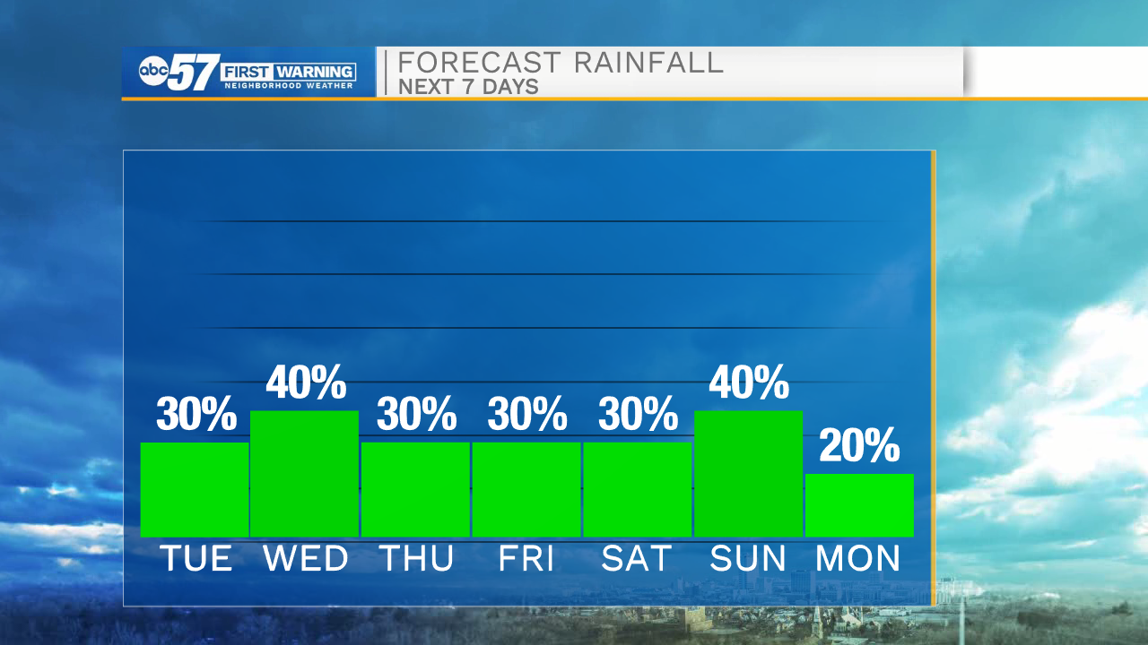
Hot and VERY humid again this week. The heat index will peak between 95 and 100 through Friday, and still above 90 through the weekend. The hottest day looks to be Wednesday. There is also the chance of pop-up afternoon/evening showers and thunderstorms. At this time widespread coverage is unlikely, but this type of pattern bears watching as storm complexes could develop. The heat breaks next week.
Tonight: Partly cloudy. Low 70.
Tuesday: Hot and humid. Isolated PM thunderstorms. High 90.
Wednesday: Hot and humid. Scattered thunderstorms. High 92.
Tuesday: Hot and humid. Isolated PM thunderstorms. High 90.
Sign up for the ABC 57 Newsletter