
-
3:08

Officials recover body of missing teenager in Lake Michigan off...
-
2:45

NCAA’s new eligibility rule could reshape Notre Dame roster...
-
1:08

Storms start this afternoon
-
0:56

Calm morning, storms tonight
-
2:43

South Bend residents see future plans for former Drewry’s Brewery
-
2:45

Damage assessment continues in Elkhart County following EF-2...
-
0:44

Indiana and Illinois set record for tornadoes
-
1:27

Community Build underway at Kathryn Park
-
2:34

Day two of searching for a missing child continues
-
3:47

The Elkhart community is searching for answers after a 2-year-old...
-
1:04

Overall pleasant for Michiana
-
1:52

South Bend Common Council issues an official apology to residents...

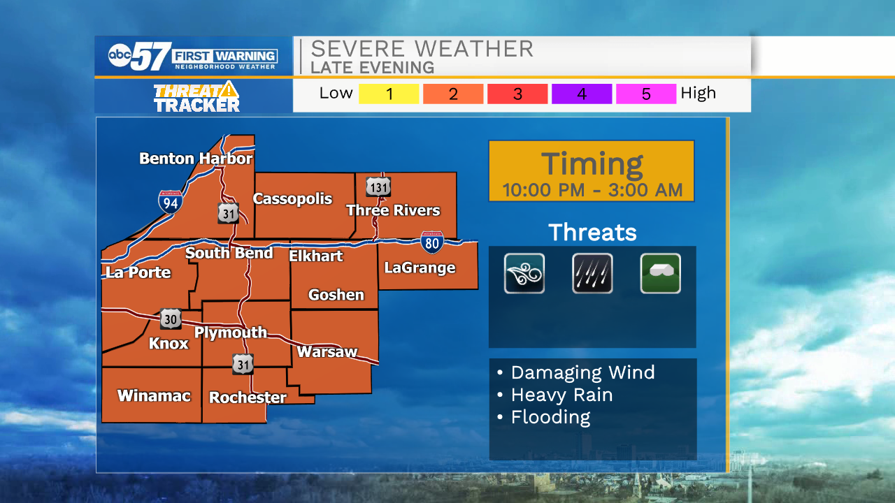
Tonight: Overnight storm threat, the severe window is 10:00 PM to 3:00 AM, scattered damaging wind and flooding possible.
Extreme heat, humidity and storms remain in the forecast through Thursday. These are the hottest days of 2021, with a heat index of +100 degrees each afternoon. Storms develop each evening; some storms could be strong to severe with heavy rain and flooding possible as well. The heat and humidity break Friday and the weekend is pleasant.
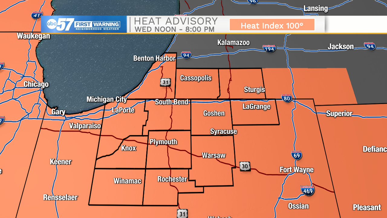
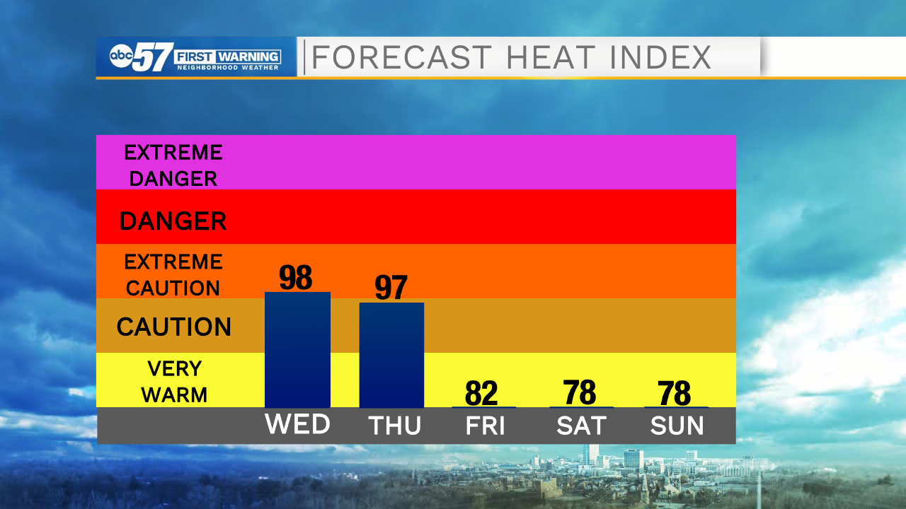
Wednesday: Extreme heat, Scattered PM thunderstorms. High 90.
Thursday: Extreme heat, Scattered PM thunderstorms. High 90.
Friday: Partly cloudy. High 82.
Sign up for the ABC 57 Newsletter