Extremely cold morning then slow warming

-
2:00

Annual Studebaker car show takes over Ironwood Plaza
-
0:55

Beautiful weekend expected
-
1:05

Truly wonderful conditions
-
0:41

One person left with serious injuries after high-speed pursuit...
-
2:15

Fort Wayne Tin Caps put an end to the SB Cubs winning streak
-
1:21

This weekend is the annual Hall of Heroes Comic Con
-
0:46

Elkhart Police Department respond to shots fired call at the...
-
3:55

ABC57 speaks with Cass County Commissioners, Judge and Interim...
-
2:48

Common Council to consider appeal options following South Bend...
-
0:52

South Bend seniors explore local parks, event centers, and available...
-
1:51

Mentone Egg Fest celebrates 80th year
-
4:58

New reactions after Notre Dame releases findings of priest sex...

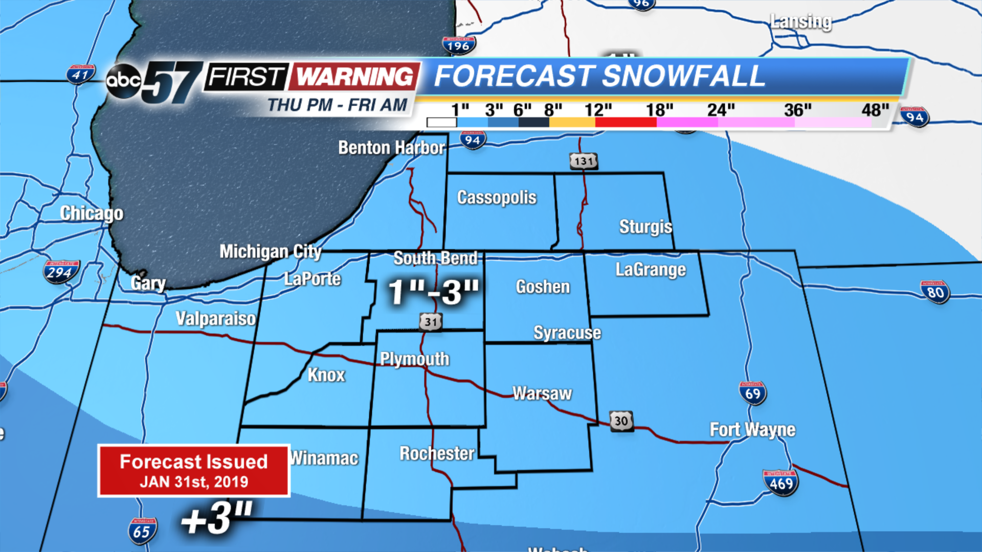
Incredibly COLD this morning with temperatures near -20 F. Temperatures slowly warm through the day, reaching near zero by midnight and continuing to warm through the night. A quick system will bring us 1-3” of snow starting late this evening lasting through Friday morning. Roads will likely be slick in spots. Daytime highs finally reach near 20F (above zero!) Friday and only continues to warm up over the weekend. Part of the Saturday will be partly cloudy but with the melting snow, fog will be possible through Monday. Scattered rain showers continues to melt the snow on Sunday and Monday. Minor flooding is likely.
Today: Extreme Cold. Mostly sunny, warming towards zero by midnight.
Tonight: Scattered light snow, temperatures warming from -2.
Friday: AM snow showers, high of 20.
Saturday: Partly cloudy, fog possible, high of 40.