
-
2:51

Severe weather expected in Michiana later today
-
2:15

Severe weather likely for portions of Michiana later today
-
2:34

Open House for a new pedestrian bridge leaves Riverside Residents...
-
2:16

Notre Dame’s CJ Carr embraces growing expectations while leading...
-
2:34

Injuries sideline key linebackers as Notre Dame leans on depth...
-
0:58

U.S. Army increases maximum enlistment age from 35 to 42
-
2:08

Large hail, damaging winds and tornadoes possible Thursday
-
1:40

Nicholas Stanley appears in court, prosecutors push to prevent...
-
3:18

Expert breaks down high gas prices and factors impacting price...
-
2:08

Westview community rallies around boys’ basketball team headed...
-
2:06

The threat for severe weather has increased
-
2:16

More sunshine today with a severe risk tomorrow

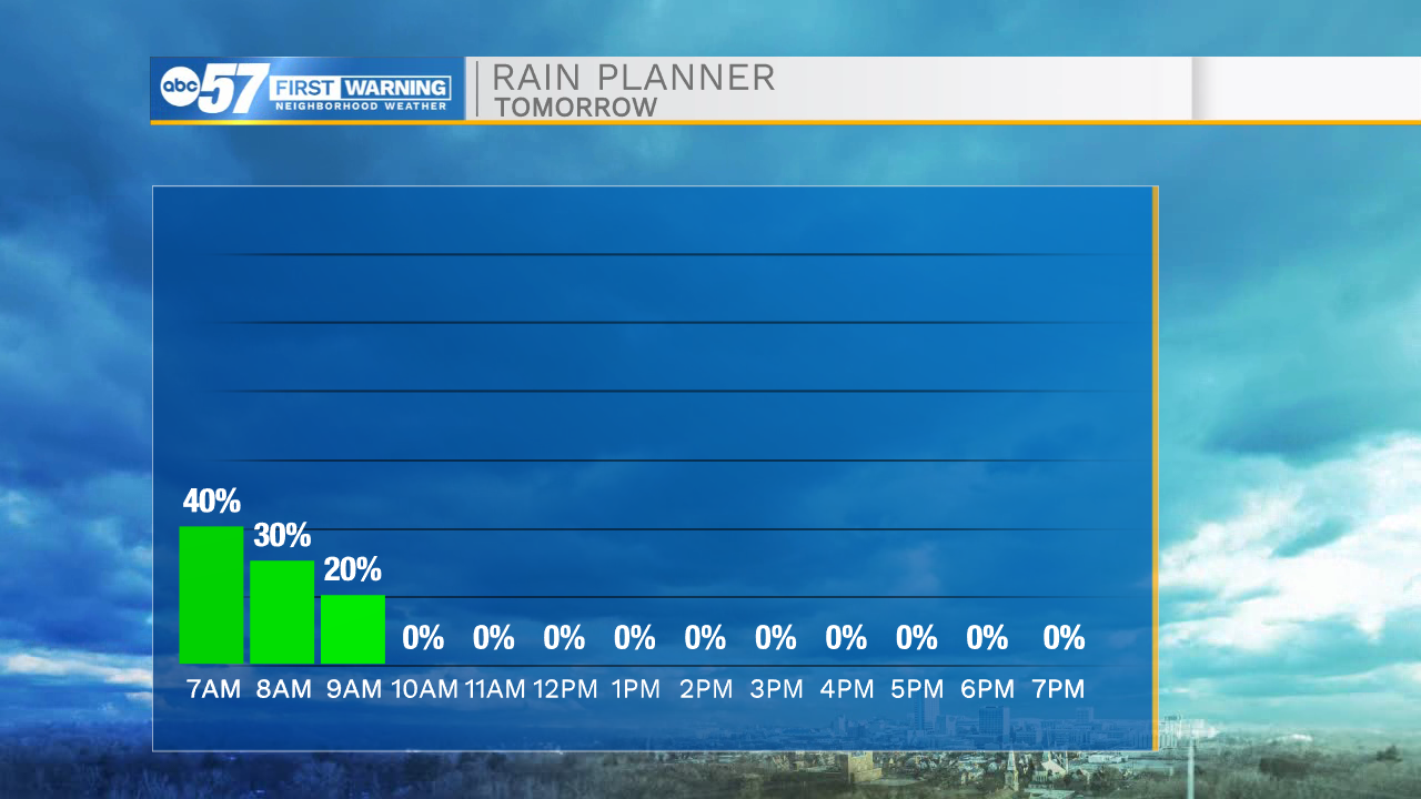
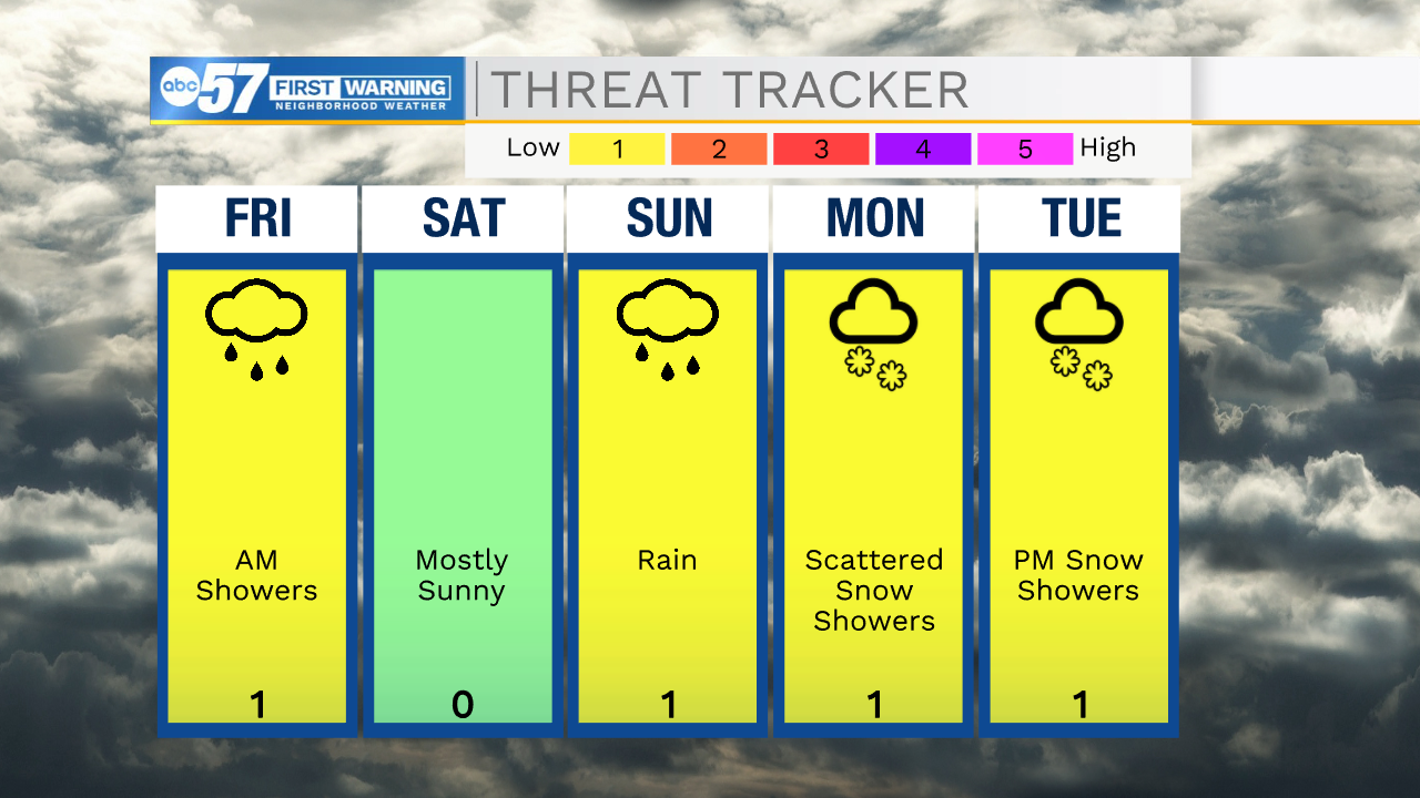
Temperatures fall into Saturday, light rain / drizzle is possible early Friday, otherwise it's a fair but chilly start to the weekend. The end of the weekend is wet before another drop in temperatures. Plan on rain Sunday with highs near 50, then highs struggle to break the freezing mark early next week. We will be cold enough for snow to fall, but the ground, and even the air is likely too warm for snow to stick. The best chance of accumulation is Tuesday night into early Wednesday, when lows fall into the mid-20s.
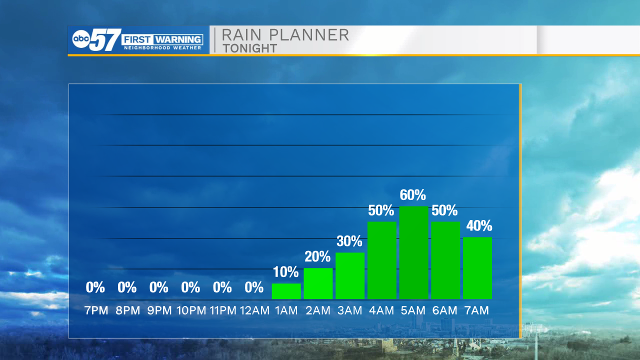
Tonight: Early morning drizzle. Low 34.
Friday: Few showers early. Partly cloudy afternoon. High 46.
Saturday: Mostly sunny. High 40.
Sunday: Rainy. High 50.
Sign up for the ABC 57 Newsletter