First accumulating snow in two weeks


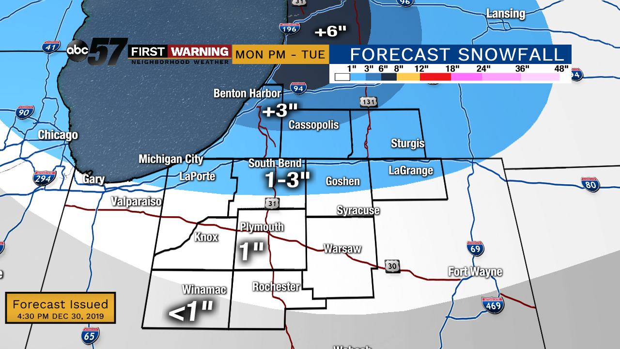
The first accumulating snow in over two weeks arrives early Tuesday morning. A quick burst of snow could bring one to three inches. The most snow falls north of US-20, with more than three inches possible across northern Berrien, Cass and St. Joseph counties in Michigan.

Morning snow could coat roads Tuesday morning but with our recent mild-spell over Christmas the ground is warm enough for melting, making for wet / slushy conditions.The snow is unlikely to last very long. Skies clear for New Year’s Day and temperatures warm towards 50 by Friday.
Tonight: Windy with snow likely. 1”-3” for most. Low of 28.
Tuesday: Morning snow showers, breezy and cloudy. High of 32.
New Year's Eve: Mostly cloudy. Low of 24
New Year's Day: Sunny. High of 38.
Thursday: Mostly cloudy, chance of rain. High of 45.