
-
0:48

Severe threat INCREASING today
-
0:54

Mild out the door, storms later
-
2:14

More storms midweek
-
2:00

Elkhart nonprofit packs and delivers food for storm victims
-
0:38

Baroda community to decide on abolishment of village government
-
1:49

La Porte County tornado damage results
-
2:30

City of South Bend using AI in a resident-focused Program
-
2:59

Elkhart County Emergency Management starts recovery process after...
-
0:58

Wonderful start to week
-
0:58

Cooler out the door
-
1:27

Updated Tornado Survey- June 1, 2026
-
1:13

Severe Weather possible midweek

Messy winter weather to end the week. Widespread system snow starts early Friday morning. The first flakes are likely to melt due to the warm ground and air temperature just above freezing. Grassy areas are likely the first to accumulate but most of Friday is wet / slushy.
Cold air surges across the lake Friday night, after midnight accumulation of more than three inches is possible across southwest Michigan, less than three inches near the state line. Snow ends Saturday morning, the rest of the day will be bitterly cold for November.
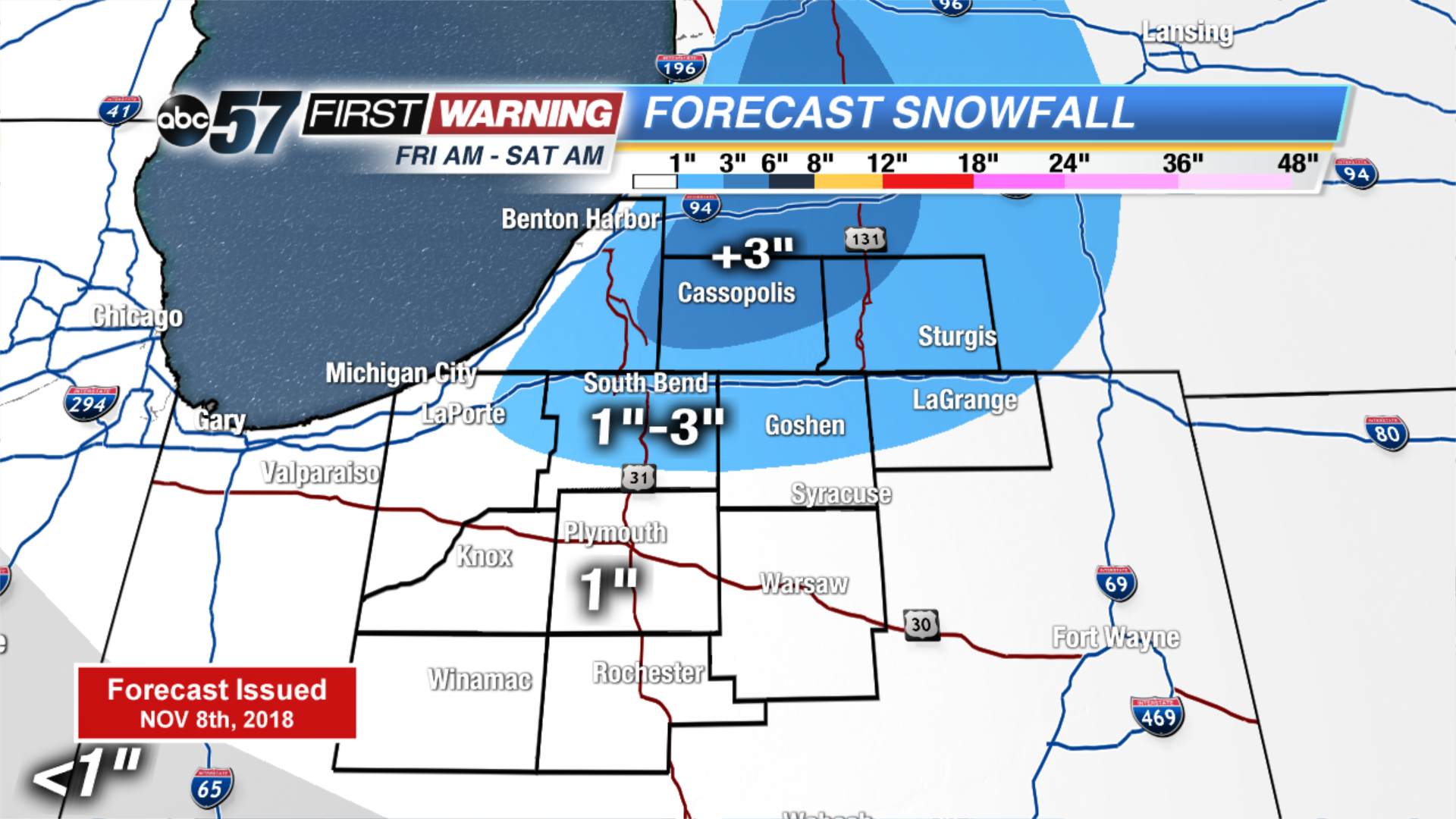
Tonight: Early AM snow/mix, low of 32.
Friday: Mix/snow showers then lake effect snow, high of 38.
Saturday: Morning lake effect snow, high of 34.
Sunday: Mostly cloudy, high of 38.
Sign up for the ABC 57 Newsletter