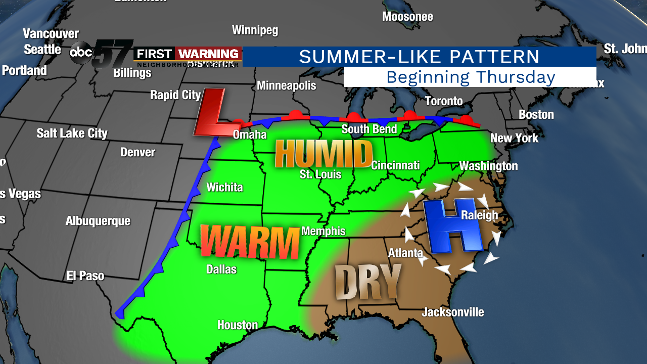
If you are completely over the chilly temperatures and seemingly endless cloud cover, we've got great news. For really the first time all year, a summer-like pattern is set to establish itself beginning later this week. Beginning Thursday, a strong, dominant area of high pressure will set up shop in the Carolinas. This will keep hot and dry conditions in place for the next week from Mississippi to Virginia. Meanwhile, for the Plains, Mississippi Valley, Midwest, Ohio Valley, and Great Lakes, southerly winds will usher in warmth, humidity and numerous chances for rain and thunderstorms. That includes Michiana.
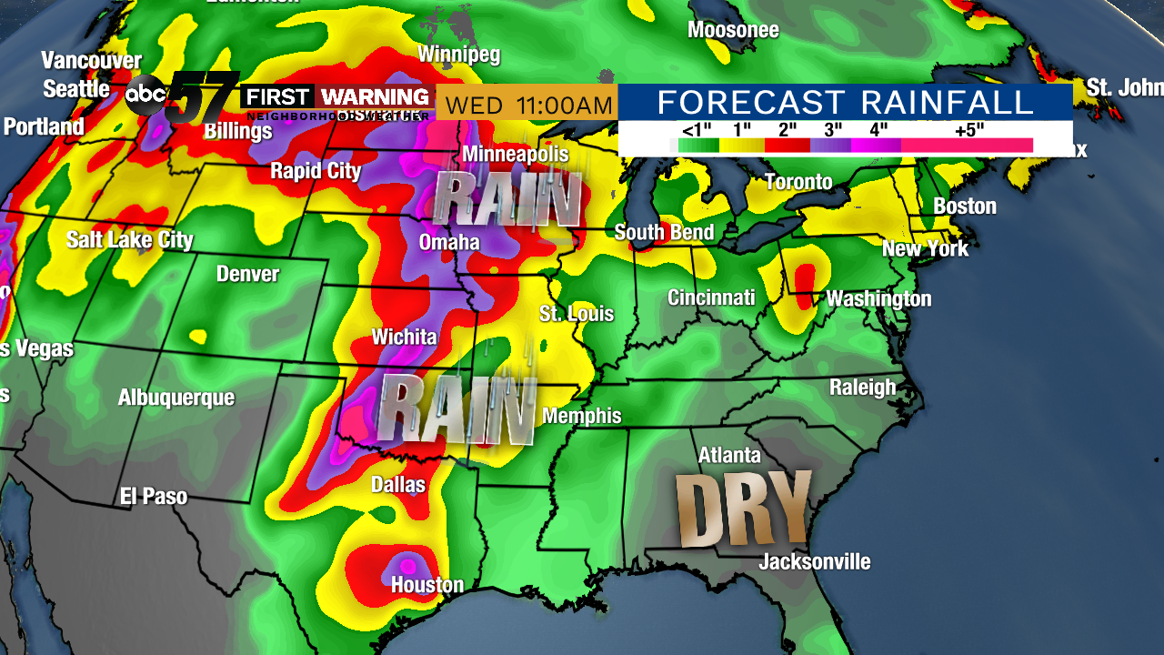
Fortunately, though, we won't see the heaviest of the rain over the next week. That will fall across the Plains and Upper Midwest. Those areas will see repeated rounds of showers and storms, which could lead to flooding. For Michiana, the threat of showers and thunderstorms exists late Thursday, Sunday and again into next week, but major rainfall isn't anticipated as of now.
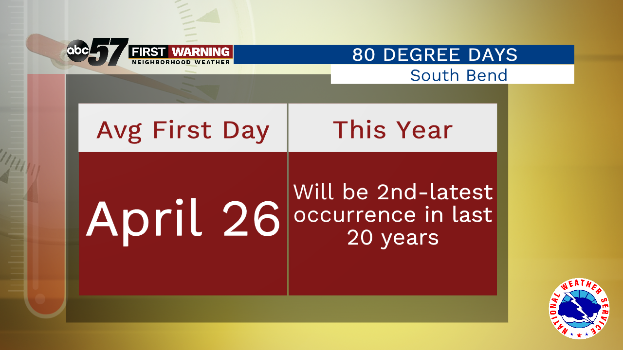
Regarding temperatures, we can essentially say goodbye to the days with highs under 60°. Looking ahead, nearly everything points toward daily highs reaching at least 60° thru the rest of May. That's a big step in the right direction after just seeing four straight days in the 50s. But we still haven't seen a day in the upper 70s. And we certainly haven't eclipsed the 80-degree mark. A typical year will give South Bend its first 80-degree day by April 26th. This year, we are looking at possibly seeing our first 80-degree reading on May 19th (this Sunday). That would be the 2nd-latest date for our first 80-degree day in the last 20 years!
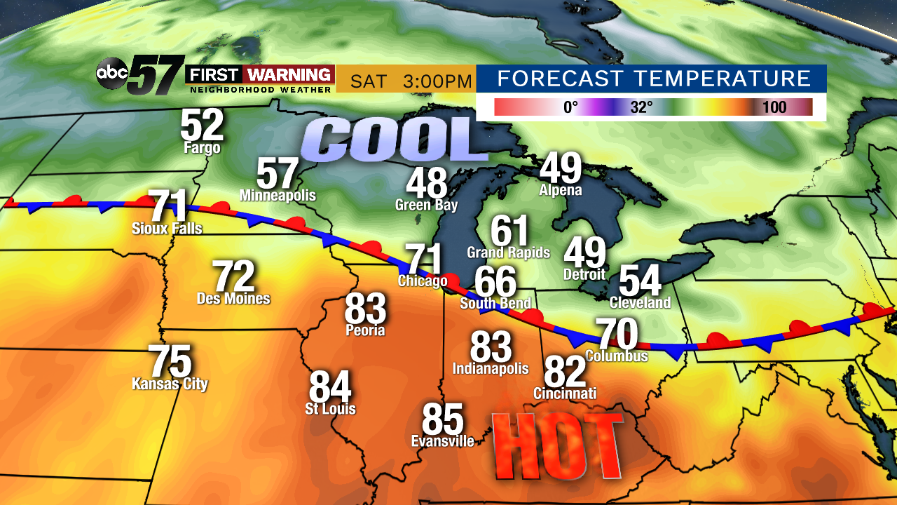
While we likely won't see 80° every afternoon, the next week will be significantly warmer than the last several weeks. Every day thru May 23rd will be in the 60s, 70s or possibly even the 80s. The days with a near-guarantee of seeing temps reach the 70s are this Thursday and Sunday, and next Monday and Tuesday. The wildcard days are this Friday and Saturday. A stationary boundary will be in place across the Midwest and Great Lakes both days. To the north of it will be cool air and to the south will be very warm to down-right hot air.
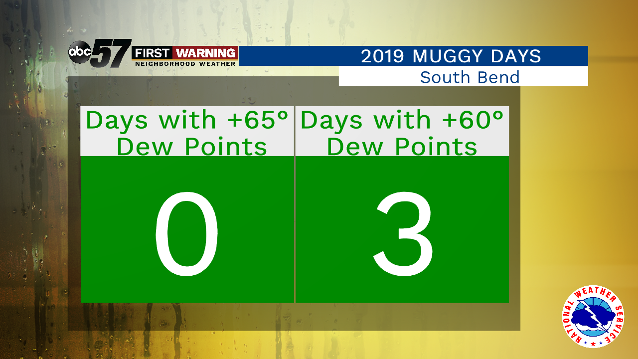
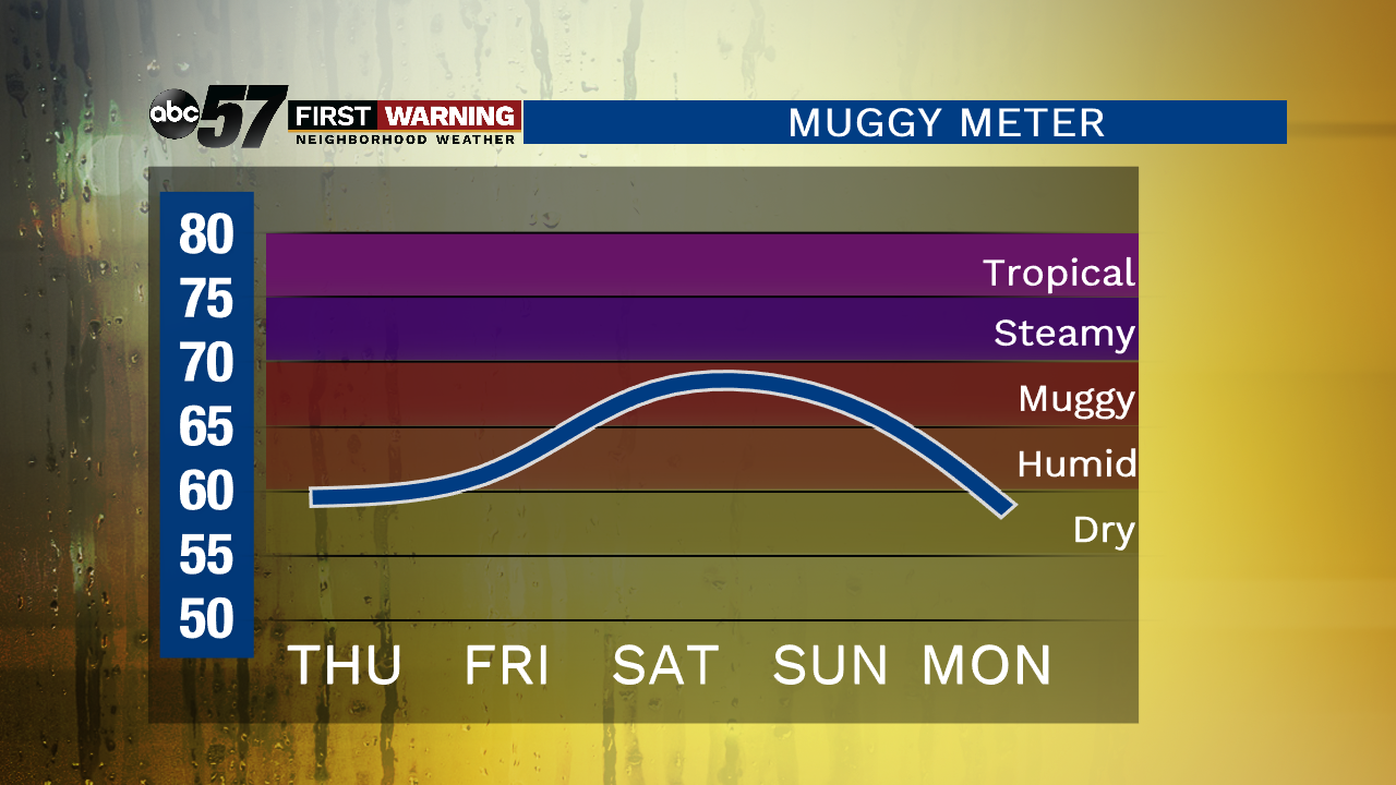
Depending on exactly where that front sets up will determine who sees 70s on Friday and Saturday, and who sees 60s. As of now, forecast models are split on temperatures for both days. That leads to a low confidence forecast for high temps Friday and Saturday. The good news is that regardless of where the front sets up, we should be no colder than 60-65°. Now that we've broken down the rain and temperatures, let's discuss the humidity. Humidity will become more of a factor beginning Thursday as dew points will rise into the 60s.
It won't be overly humid or steamy by any means, but the humidity will certainly be at least noticeable late Thursday, early Friday and again this weekend into next week. The pattern behind our warming temps, increasing humidity and rain chances for the next week will also favor a significant threat of severe thunderstorms for nearly a week straight. We will break that down in detail on Wednesday.

