Friday, January 10th, 2020
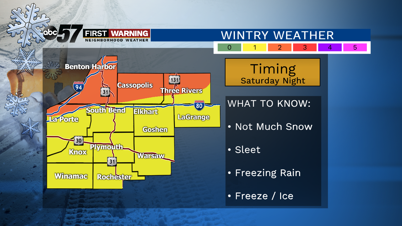
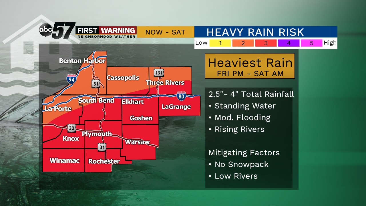
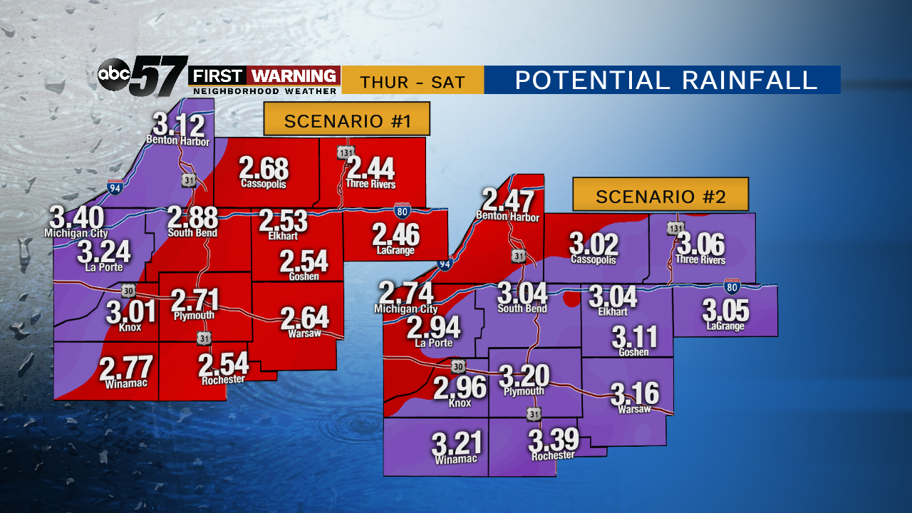
Rain showers last on and off through today with temperatures rising into the low 50s. The heaviest rain is expected Friday night into Saturday morning. 3-4" of rain is expected with locally higher amounts possible. This rain could be record breaking and flooding is likely. During Saturday late afternoon, the rain changes over to a wintry mix with freezing rain possible in our northern counties. Snow briefly mixes in late Saturday evening and it all wraps up early Sunday morning.
While the rain may be done, rivers will still be rising Sunday and Monday. Thankfully both of those days itself are quieter with mostly cloudy skies.
Today: Rain Showers. High of 52.
Tonight: Heavy rain, flooding possible, temperatures hold close to 40.
Saturday: Heavy rain, flooding possible, breezy, freezing rain possible, temperatures fall from 39.
Saturday Night: Sleet possible, standing water will freeze, low 24.
Sunday: Mostly cloudy. High of 34.