How to determine where freezing rain will be Friday morning
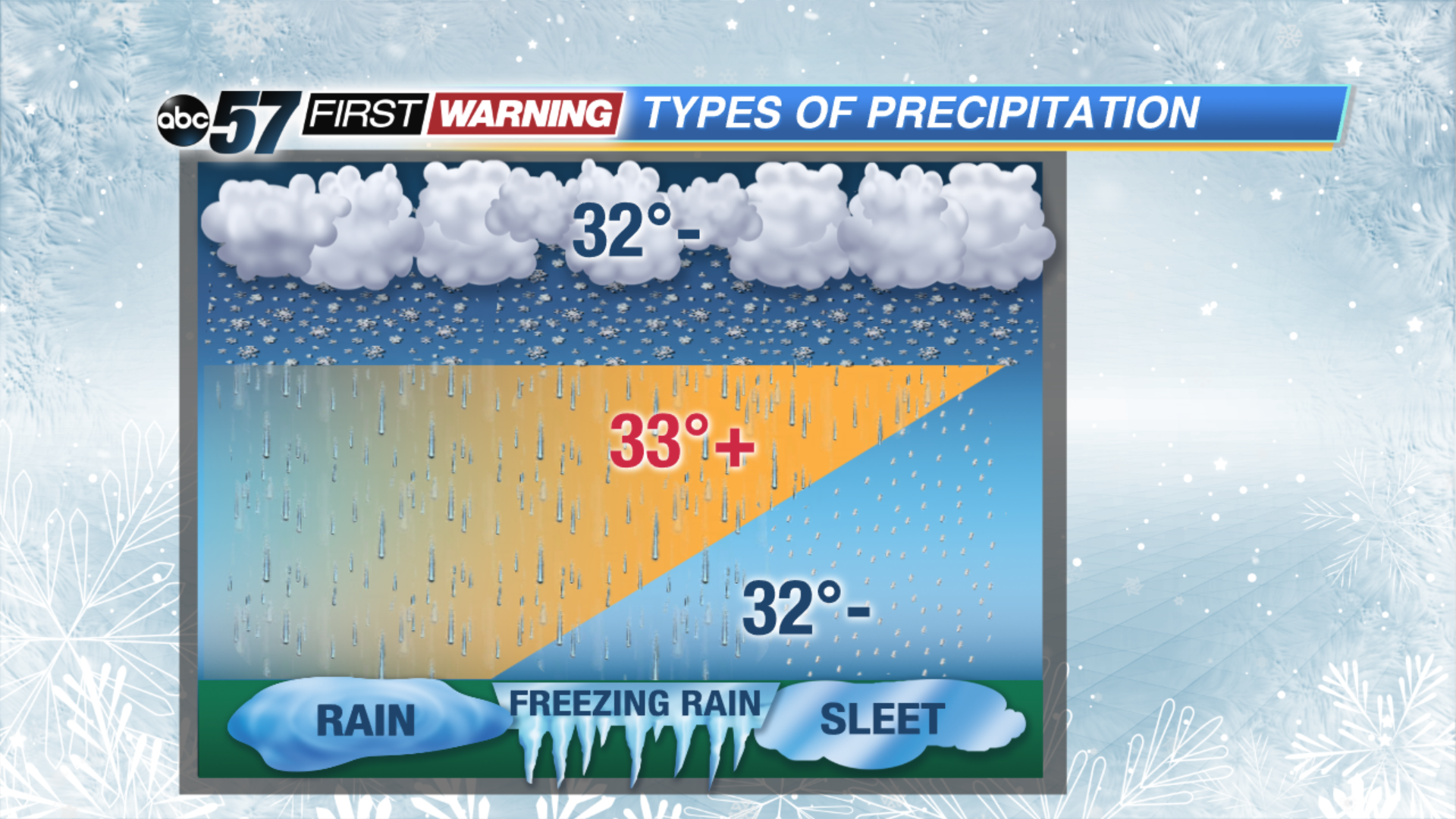
The roads will be slick in several spots by tomorrow morning, because of the freezing rain that is possible late tonight. In tonight's case, freezing rain will be possible because there will be a warmer layer of air in the upper atmosphere, pancaked between sub-freezing air.
Snowflakes will fall into this 35 degree layer of air and melt into rain, and then re-enter the sub-freezing air on the way to the ground. In the spots where surface temperatures only drop to around 30 or 31 degrees tonight, freezing rain is most likely to occur. On the other hand, in spots where the temperature falls into the upper 20s and further away from 32, sleet is more likely, because those rain drops will have the ability to freeze again.
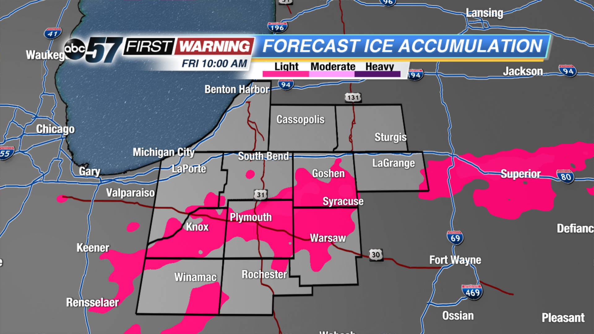
Take a look at where light ice accumulations will be most possible tomorrow morning. The US-30 corridor is at risk because that's where temperatures will likely be right at 32 degrees, some rural spots further south may see some freezing rain too. Up towards Michigan it is less of a risk because temperatures will be in the upper 20s.
Be extra careful during the Friday morning commute, and watch ABC57 starting at 4:30 AM to get a check on current conditions and road issues.


