
-
1:06

Marshall County Humane Society reschedules Dog Egg Hunt
-
2:01

Martin Luther King Dream Center hosts MLK March in South Bend
-
1:54

South Bend Cubs opener postponed by weather, but fans still find...
-
2:01

Sights and sounds from South Bend Cubs Opening Day
-
1:32

NIPSCO ’flatly rejected’ further negotiations, USW workers...
-
3:36

The art of groundskeeping at Four Winds Field
-
3:32

The history behind America’s only ballpark synagogue turned...
-
1:59

South Bend opens season against Quad Cities in familiar Midwest...
-
4:21

South Bend Cubs owner discusses $48M stadium expansion, changes...
-
3:19

A look into the new South Bend Cubs 2026 roster
-
5:17

Expansion goes beyond Four Winds Field, new restaurants, bars,...
-
6:18

What’s new this season? South Bend Cubs unveil major improvements...

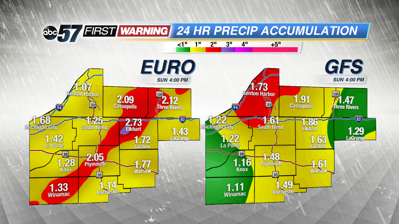
Much needed rain returns Friday and stays in the forecast through Sunday. Friday will start with showers in the early morning, followed by a lull, then a line of storms in the afternoon. Afternoon storms could be strong/severe, much of this will depend on clearing of morning showers.
Regardless of severity, a slow moving low pressure system looks to spin over the region bringing multiple chances of rain through Sunday. Estimated total rainfall up to two inches would be highly beneficial in reducing our monthly rainfall deficit. Skies clear by Monday, next week looks mostly dry.
Tonight: Chance of showers by morning, low 68.
Friday: Scattered showers and storms, humid, high of 80.
Saturday: Cloudy, scattered showers, high of 74.
Sunday: Mostly cloudy, scattered showers, high of 78.