


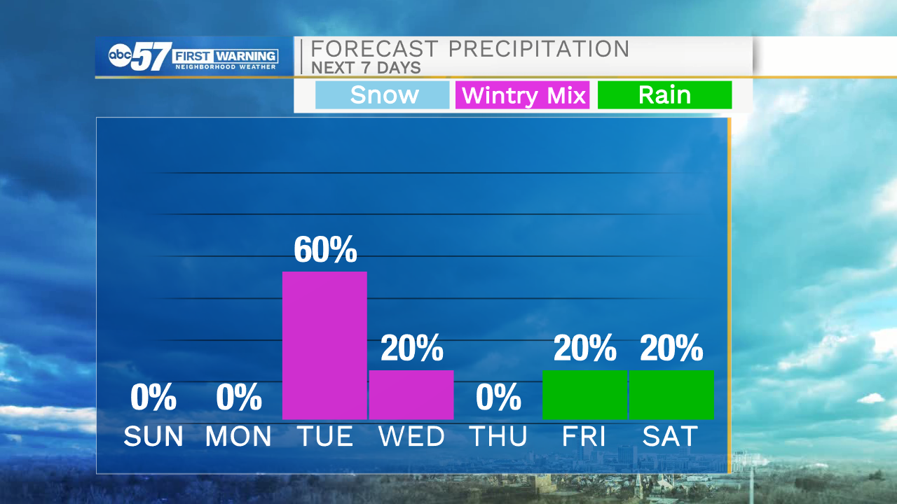
A few clouds will move into Michiana tonight to help keep temperatures right around freezing in most areas. There is a frost advisory for tomorrow morning, so make sure to move those temperatures sensitive plants indoors, or cover them up outside. Highs tomorrow afternoon will top out in the lower 60s under partly cloudy skies. Monday looks to stay dry with lots of sunshine and high temperatures topping out in the mid 60s. Our next system moves in during the early morning Tuesday bring rain, wintry mix, and snow. Some minor snow accumulation is possible. Temperatures look to drop into the upper 20s Wednesday morning. This could cause some damage to the fruit crop here in Michiana.
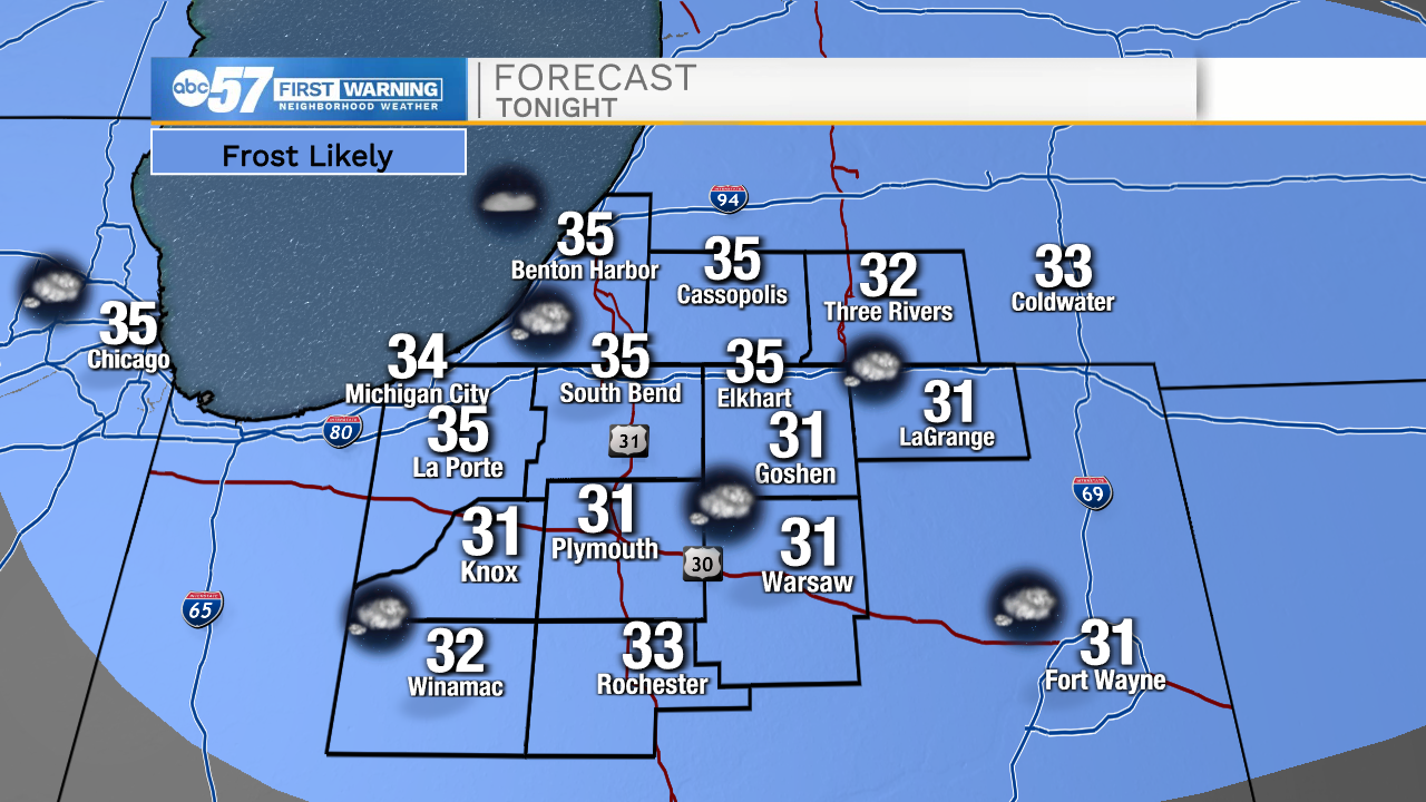
Tonight: Partly cloudy. Low 35.
Tomorrow: Partly cloudy. High 60.
Monday: Mostly sunny. High 64.
Tuesday: Rain, snow, and wintry mix. High 41.