
-
3:08

Officials recover body of missing teenager in Lake Michigan off...
-
2:45

NCAA’s new eligibility rule could reshape Notre Dame roster...
-
1:08

Storms start this afternoon
-
0:56

Calm morning, storms tonight
-
2:43

South Bend residents see future plans for former Drewry’s Brewery
-
2:45

Damage assessment continues in Elkhart County following EF-2...
-
0:44

Indiana and Illinois set record for tornadoes
-
1:27

Community Build underway at Kathryn Park
-
2:34

Day two of searching for a missing child continues
-
3:47

The Elkhart community is searching for answers after a 2-year-old...
-
1:04

Overall pleasant for Michiana
-
1:52

South Bend Common Council issues an official apology to residents...

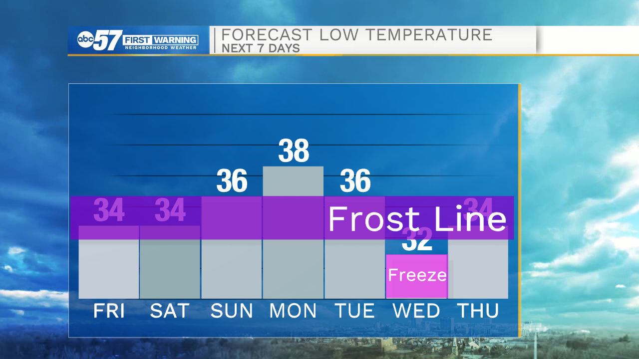
Cool weather continues, morning frost/freeze is the greatest concern. Sensitive plants and the fruit crop that have budded and bloomed early due mild weather in early spring are prone to damage. The weekend is slightly warmer, highs progress toward the 60s by Monday. Next Tuesday another cold front will drop temperatures, bring a chance of rain, and possibly freezing temperatures into Wednesday morning.
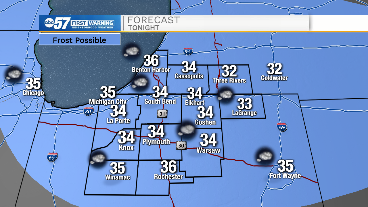
Tonight: Clouds clearing. Frost possible. Low 34.
Friday: Mostly sunny. High 54.
Saturday: Mostly cloudy. High 56.
Sunday: Partly cloudy. High 58.

Sign up for the ABC 57 Newsletter