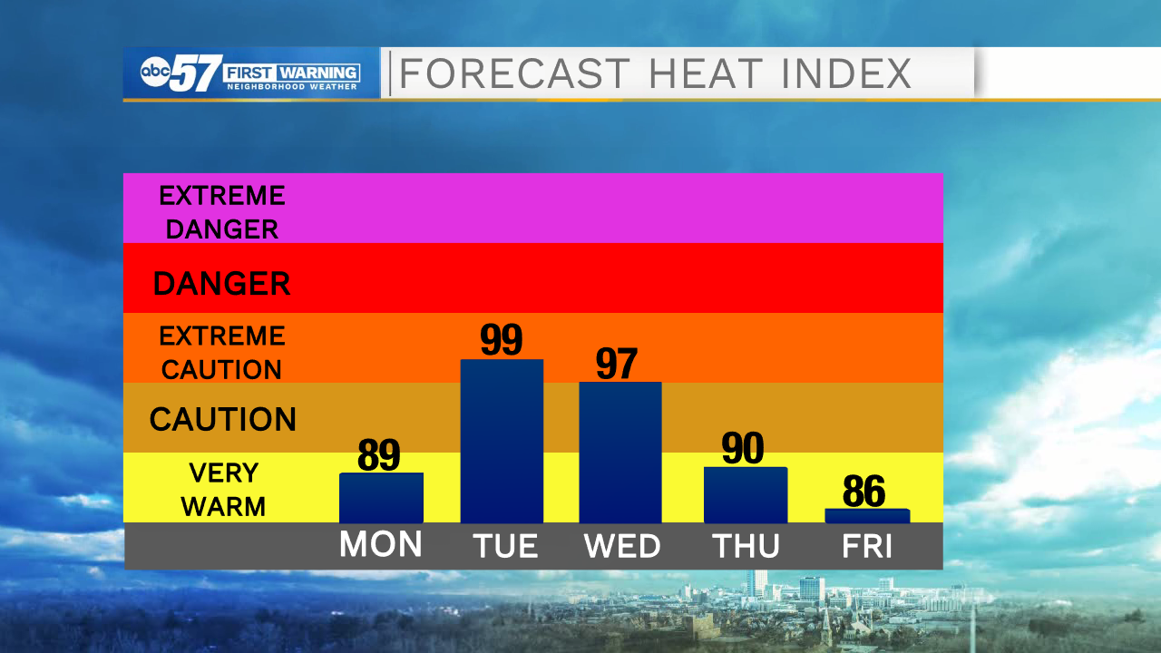
Heat index values will near the triple digits during the middle of the week

-
2:34

From Niles to South Bend: Jays 2 Keeps the Spirit Alive for basketball...
-
0:46

44th annual Tri Kappa Antique Show boosts charities and scholarships
-
1:48

Scattered showers this evening, Much cooler overnight
-
1:50

Showers and storms this afternoon
-
0:20

One person injured in shooting
-
0:36

Eddies Circuit Robotics holds competition Saturday
-
0:32

21st annual Nappanee Model Train Show
-
0:38

Local boys basketball team headed to IHSAA state finals
-
3:49

Midwest Meowfest brings kitten advocacy to attendees, new homes...
-
1:52

Mild tonight, showers tomorrow
-
1:43

Pleasant to start the weekend
-
3:06

Pulaski County weighs stricter solar rules amid resident concerns

Tonight looks dry and quiet with low temperatures dropping into the lower 60s. Tomorrow will also remain dry, but heat and humidity will continue to climb. Highs tomorrow afternoon will top out in the upper 80s. Moisture will surge northward bringing better rain and storm chances for Tuesday and Wednesday. Due to the combination of heat and moisture, the heat index will climb near the triple digits during the middle part of the week. Make sure to stay hydrated and take plenty of breaks as needed. Above average temperatures will linger into next weekend, along with low rain and storm chances.
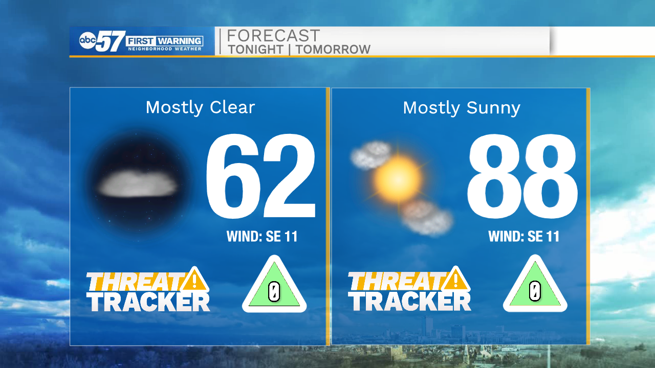
Tonight: Mostly clear. Low 62.
Tomorrow: Mostly sunny. High 88.
Tuesday: Isolated showers/storms. High 90.
Wednesday: Scattered showers/storms. High 90.