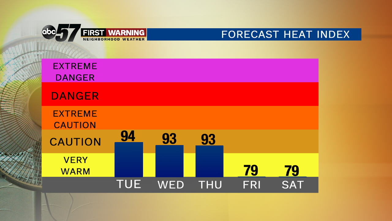
The heat wave and active weather pattern begins today. Temperatures top out near 88 degrees but with the humidity it will feel like it’s in the 90s. That hot and sticky pattern continues for Wednesday and Thursday as well. Due to the set-up, isolated showers and storms will be possible through Thursday. A couple of stronger storms cannot be ruled out. For a live look at radar wherever you are, you can download our ABC 57 Weather App.
Relief from the heat comes our way Friday morning as a cold front swings through. This will bring us scattered showers and storms along with windy conditions. It brightens up for Saturday but the mild temperatures don’t last long. We warm back up into the 80s next week.
Today: Partly cloudy, isolated shower/storm. High of 88, humid.
Tonight: Chance early, partly cloudy. Low of 72.
Wednesday: Partly to mostly cloudy, isolated showers/storms. High of 87, humid.
Thursday: Partly to mostly cloudy, isolated showers/storms possible. High of 86, humid.