Heating up Thursday with thunderstorms on Friday

-
0:57

Sunny and windy today
-
5:10

Pop-Up Kitty Cafe coming to Michigan City
-
2:51

Nappanee will soon be home to the World’s Largest Cabinet
-
0:38

Drying out and warming up
-
1:15

Cold and bleak weather to start off the day
-
3:49

Asking for Accountability: Michiana Elected Officials on on-going...
-
3:37

South Bend Cubs explain weekend washout
-
4:02

Early voting is underway as Indiana prepare for its May 5 primary...
-
3:27

Tax-related scams to watch out for
-
0:09

Crews repair weekend washout under Coloma train track
-
0:58

Chilly and sunny Tuesday ahead
-
0:41

Elkhart police investigating Monday night shooting

ABC57 First Warning Neighborhood Weather Forecast
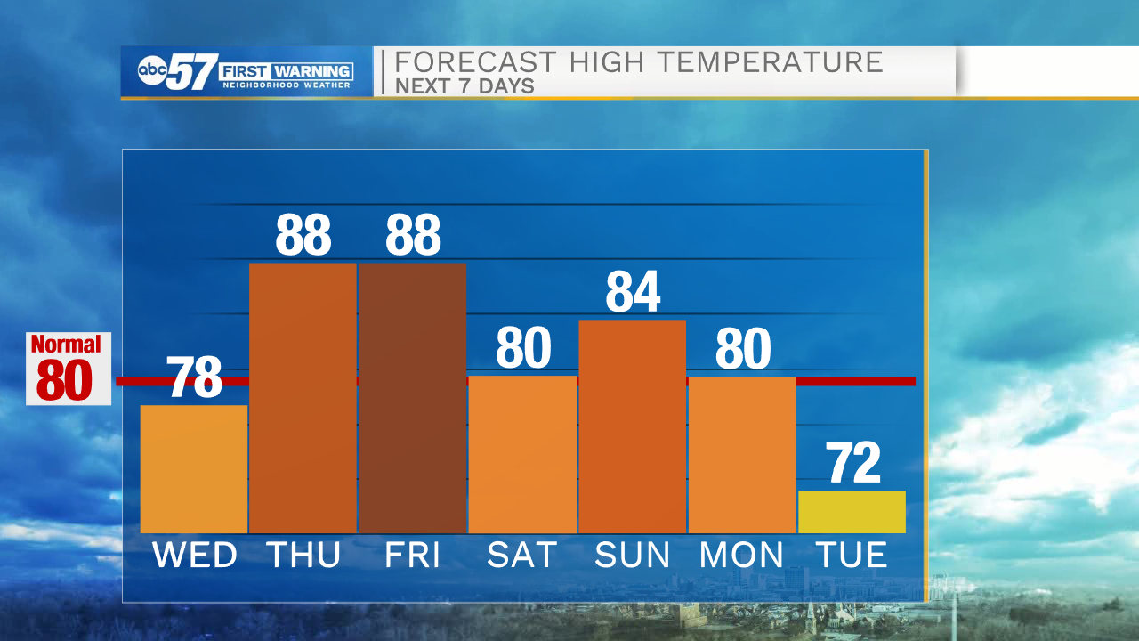
Wednesday, June 16th, 2021
The sunshine and comfortable weather continues through midweek. Temperatures climb back into the upper 80s by Thursday and stay there for Friday. The next chance of rain arrives late Thursday night as scattered thunderstorms move into the area. It lasts through Friday morning and could linger into the afternoon. It looks like another line of storms will develop along a cold front Friday evening. Storms could be strong with heavy rain and gusty wind. Brighter and comfortable over Father's Day weekend. Much needed rain is possible again on Monday.
Today: Sunny. High 78.
Tonight: Mostly clear. Low 52.
Thursday: Mostly sunny. High 88.
Friday: Morning thunderstorms. High 88.