
-
1:16

Chilly today, cold tonight
-
3:16

Importance of water safety with warm weather around the corner
-
5:38

Celebrate with the Ivy Tech Impact Gala
-
5:27

Magician Andy Gross comes to Goshen Theater
-
0:53

Cold and soaking rain through this morning
-
2:11

This week’s ABC57 Cub Reporter is Lucas Castillo
-
2:48

Mishawaka Mayor Dave Wood gives the State of the City address
-
3:34

Indiana leads the U.S. in gas price increases
-
1:31

The Great Futures Breakfast held by the Elkhart Boys & Girls...
-
1:10

Boys & Girls Club of Benton Harbor wins a violence prevention...
-
2:28

Local landscaper turns heads with his manicured lawns and young...
-
2:38

Skylar Diggins returns to the Midwest as Chicago Sky look for...

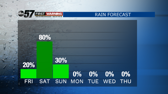
Widespread light to moderate rain Thursday evening, tapering off after midnight.
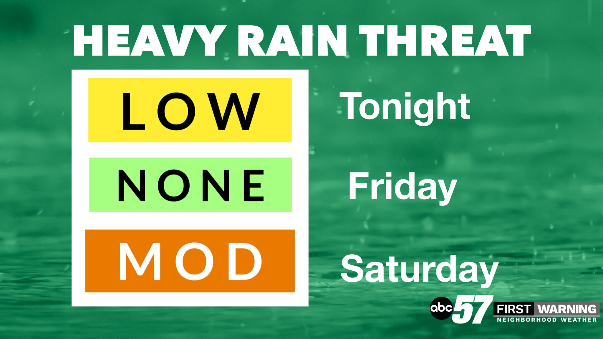
Friday is the lull between rounds of rain, cloudy with some drizzle possible. Widespread heavy rain is likely Friday night through midday Saturday, more than an inch of rain is possible. Temperatures spike near 60 Saturday afternoon and scattered thunderstorms are possible Saturday evening. Sunday is breezy and much cooler with a few lingering showers in the morning. Next week is mostly dry with high temperatures near 50.
Tonight: Evening rain, cloudy. Low 42.
Friday: Cloudy, few showers possible. High 58.
Saturday: Rain/Thunder possible. High of 62.
Sunday: Mostly cloudy, breezy. High of 50
Sign up for the ABC 57 Newsletter