
-
1:40

Elkhart holds annual Memorial Day parade
-
3:37

Law enforcement, veterans and more participate in Back the Blue...
-
3:47

Families honor lost loved ones as lifeguards return to South...
-
1:16

No shortage of sunshine today
-
1:37

Memorial Day parade forecast
-
4:51

Local band ’The Erly’ stops by ABC57 ahead of June 3 performance
-
1:17

VERY foggy first few hours of the morning
-
1:57

A local taste brings New Carlisle community together on race...
-
0:45

Pancakes help raise funds to support the Alzheimer’s Association
-
1:03

Lighter rain expected into the afternoon
-
1:04

Non-severe storms expected
-
1:16

Showers start this morning

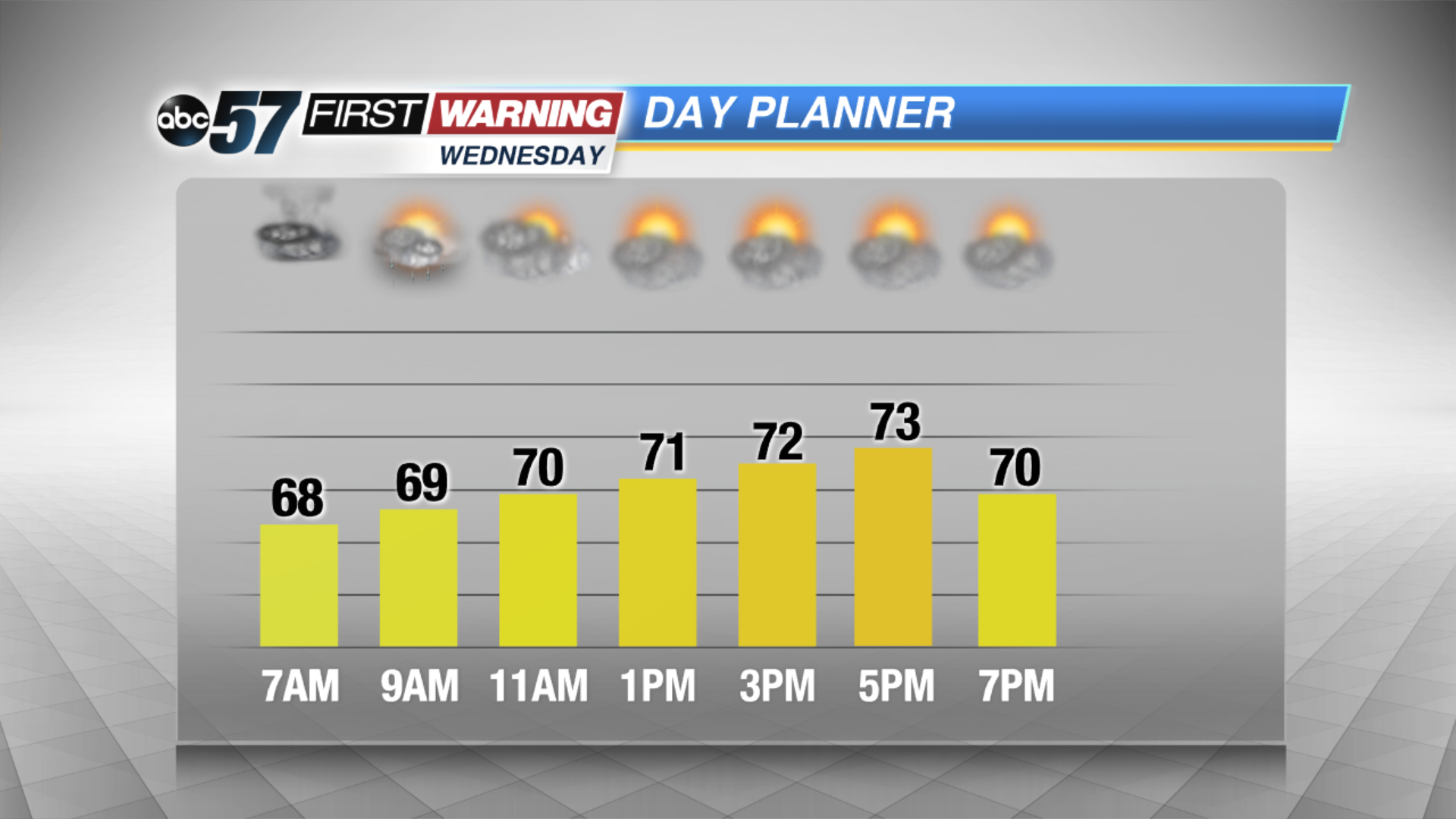
Scattered showers and storms Tuesday night will continue the threat of heavy rain and flooding through Wednesday morning. The humidity lasts for one more night.
The forecast trends drier and less humid Wednesday afternoon and Thursday, skies start to break and the humidity drops through midweek. Friday another round of showers and storms will bring the potential for more heavy rain and possible flooding. This weekend will not be as hot with highs in the 70s.
Tonight: Scattered showers and storms, low of 68.
Wednesday: Morning showers and storms, high of 74.
Thursday: Partly cloudy, high of 80.
Friday: Scattered showers and storms, high of 76.
Sign up for the ABC 57 Newsletter