High heat is here to stay


The heat is making a big comeback! We will quickly warm into the 90s for the weekend, and it will not end there.
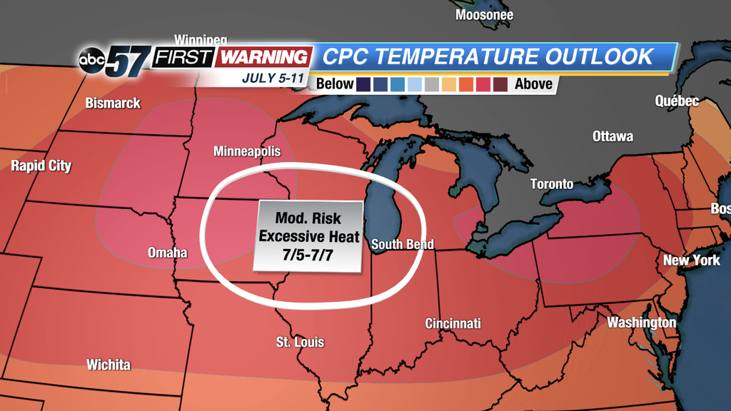
The Climate Prediction Center’s 8-14 day temperature outlook is showing that temperatures will be much higher than normal for most of the Midwest from July 5th through the 11th. In the bright red bull's-eyes, that’s where there is the highest chance for warmer than normal temperatures. There is even a moderate risk of excessive heat for the area circled in white. This includes Michiana, and it is during the busy holiday week from July 5th through 7th.
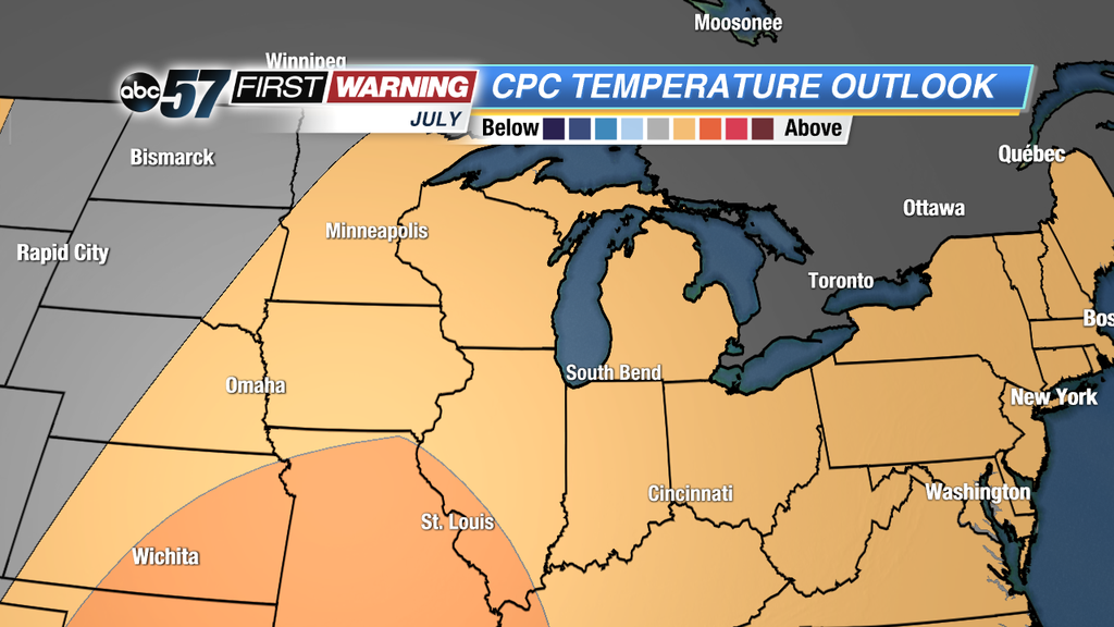
The outlook for the whole month of July shows that the heat will stick around through the end of the month as well. From this map we can conclude that the second half of the month may not be as hot as the first half, but still overall warmer than normal.
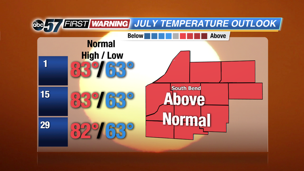
Keep in mind, July is our hottest month of the year. High temperatures throughout the month consistently average around 83 Degrees until the last week when they average 82 Degrees. For high temperatures to be above average, they will be in the mid-upper 80s and 90s, and with temperatures that high, there is always a risk of heat exhaustion and heat stroke. Stay safe and get your weather updates with ABC57 News.