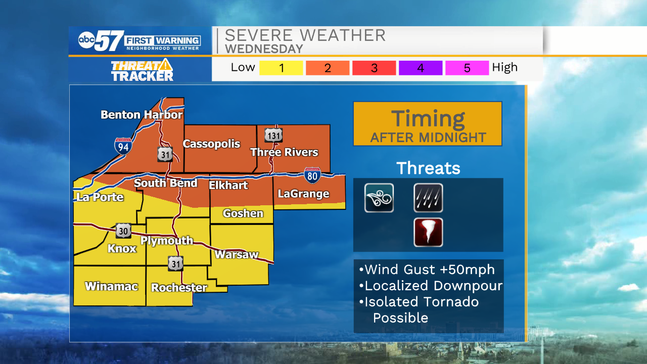
Hot and humid, storms arrive Wednesday night

-
0:57

The Unity Gardens brought music, food, and crafts for their Westside...
-
1:50

Quiet evening, Storms after Midnight
-
0:57

Deer Creek Hunt Club throws a skeet shoot event for Deputy Jon...
-
1:44

Two rounds of storms Monday
-
1:07

Mini heat wave starts out the door
-
2:23

La Porte community rallies for Sammy Strong Benefit, raising...
-
1:57

The Potawatomi Zoo opens its gates to Zoo Nights Live
-
2:50

Carson Kvapil wins his first O’Reilly Auto Parts Series win...
-
1:10

William Tuffs honored as the only Indiana man who took part of...
-
0:50

Beacon Health held a Health and Wellness fair for the community
-
1:03

Warm conditions start overnight
-
1:02

Another pleasant day

ABC57 First Warning Neighborhood Weather Forecast
Tuesday, July 27th, 2021
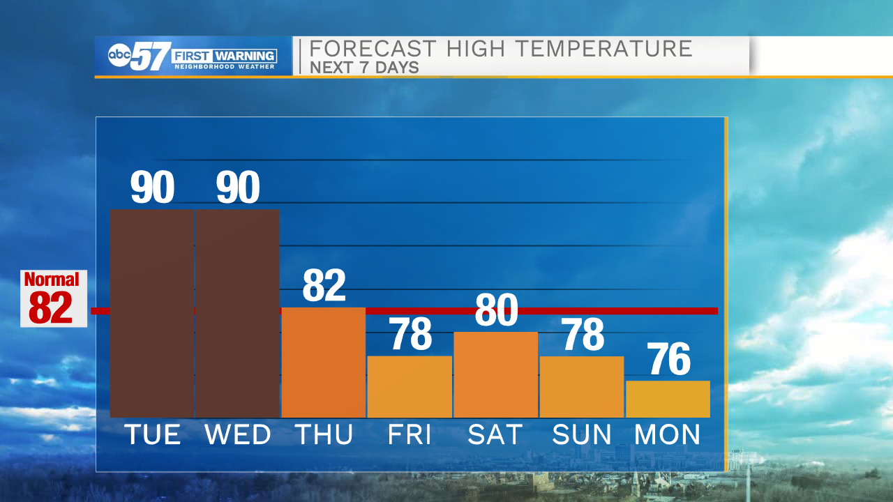
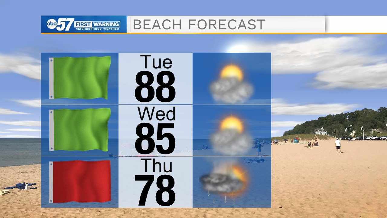
The sunny, hot and humid weather continues. We'll hold onto the heat and mugginess until Thursday. Start making plans to cool off at the beach or by the pool. A cold front brings scattered showers and storms on Thursday as well as relief from the heat. As storms moves in late Wednesday night into Thursday morning, they could be strong to severe.
Friday looks beautiful and comfortable as we only top out in the upper 70s. Despite a chance of rain Saturday night, the weekend looks nice too. A mix of sun and clouds with a high near 80.
Today: Mostly sunny. High 90.
Tonight: Mostly clear. Low 70.
Wednesday: Partly cloudy. High 90.
Thursday: AM showers/storms. High 82.