


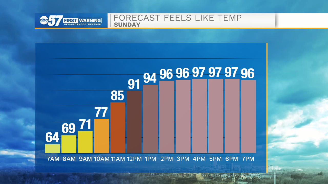
A hot, humid day to end our weekend. Temperatures will climb to the low 90s this afternoon. With humidity, it will feel like the mid to upper 90s outside.
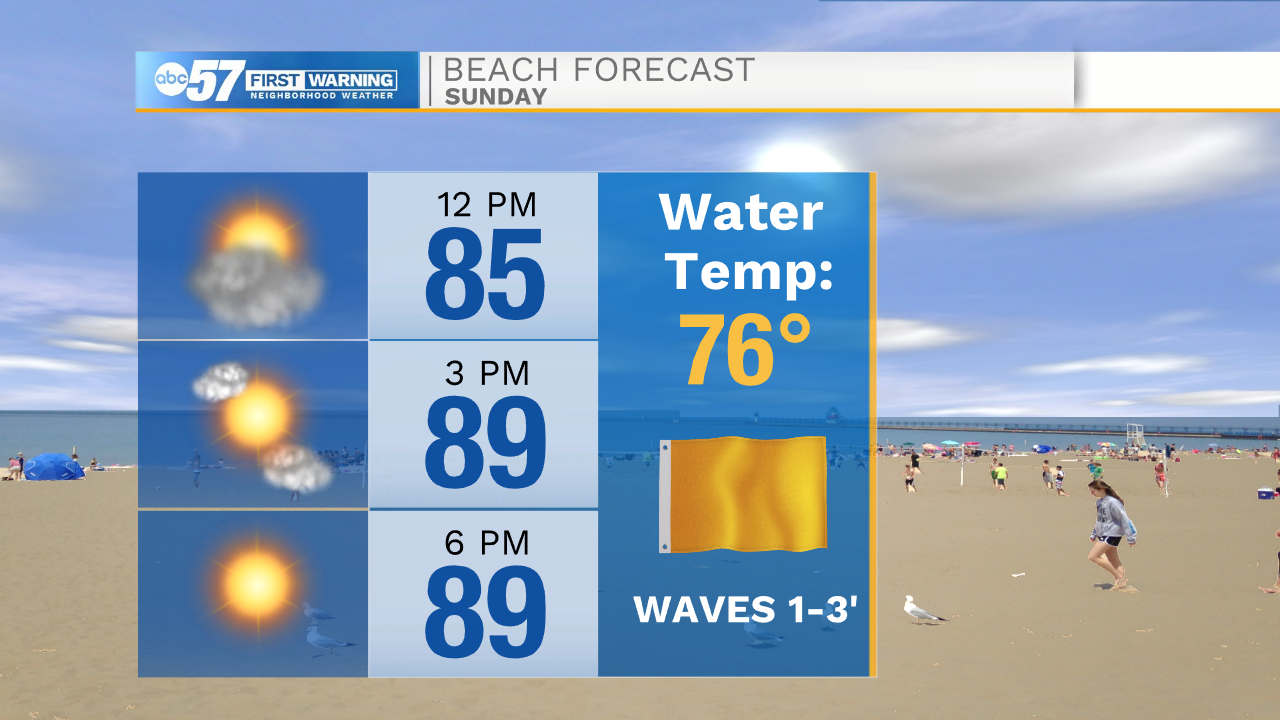
Take it easy and drink plenty of water if you are going outside this afternoon. If you’re heading to the beach to cool off, there is a moderate swim risk this afternoon (yellow flag) with waves 1-3 feet.
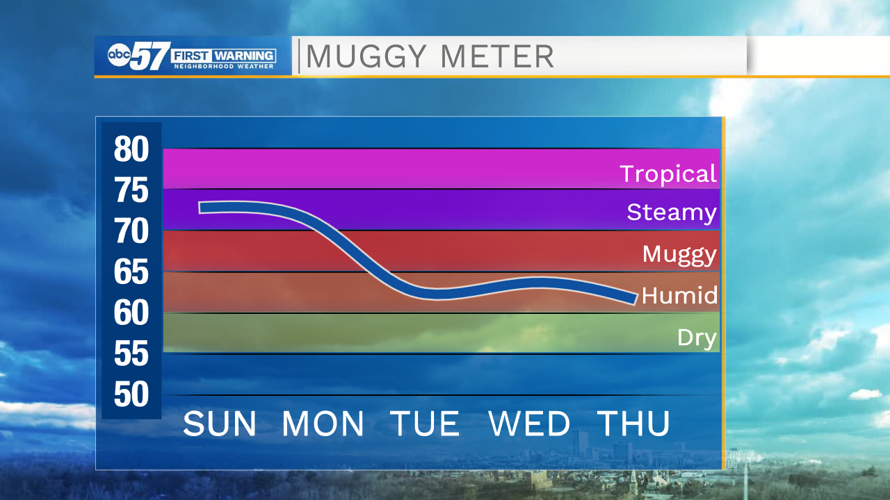
There is a mix of clouds and sunshine today. We should stay dry until early Monday morning. Tonight will feel muggy, with a low around 74, so leave your air conditioning on overnight. Scattered showers and a few thunderstorms are expected throughout the day Monday. Most will clear around dinner time, leaving you a few hours to get outside at the end of the day. These showers and storms are along a cold front. This will bring more seasonable temperatures and less humid air to Michiana.
Expect dry weather the rest of the work week and highs in the low to mid 80s.
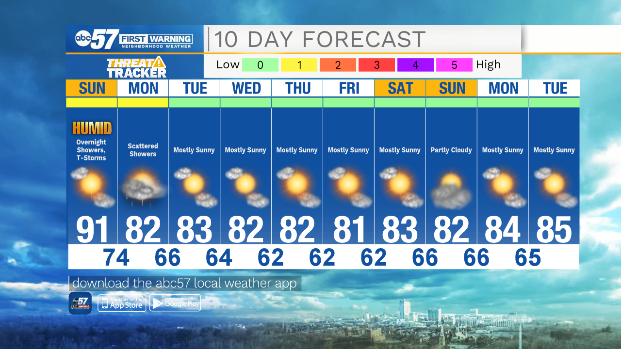
Today: Mix of sun and clouds. Hot, humid. High 91.
Tonight: Showers late, possibly a thunderstorm. Low 74.
Monday: Scattered showers and a few thunderstorms. High 82.
Tuesday: Mostly sunny. High 83.