


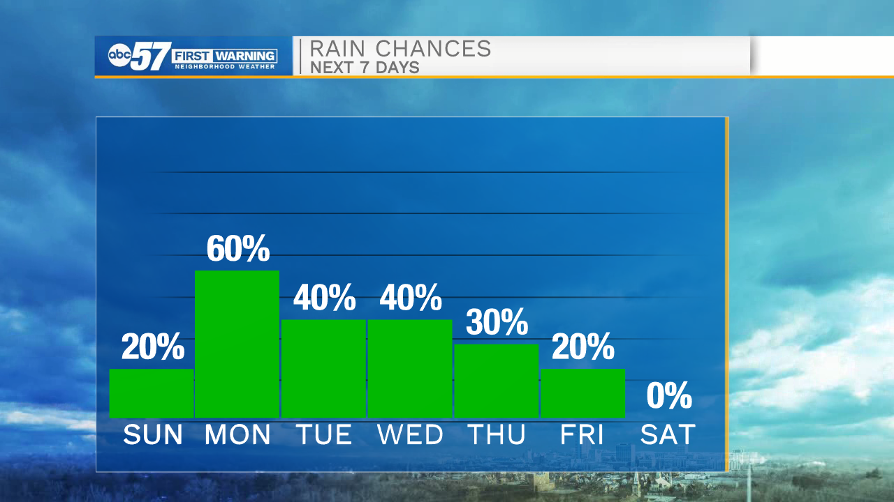
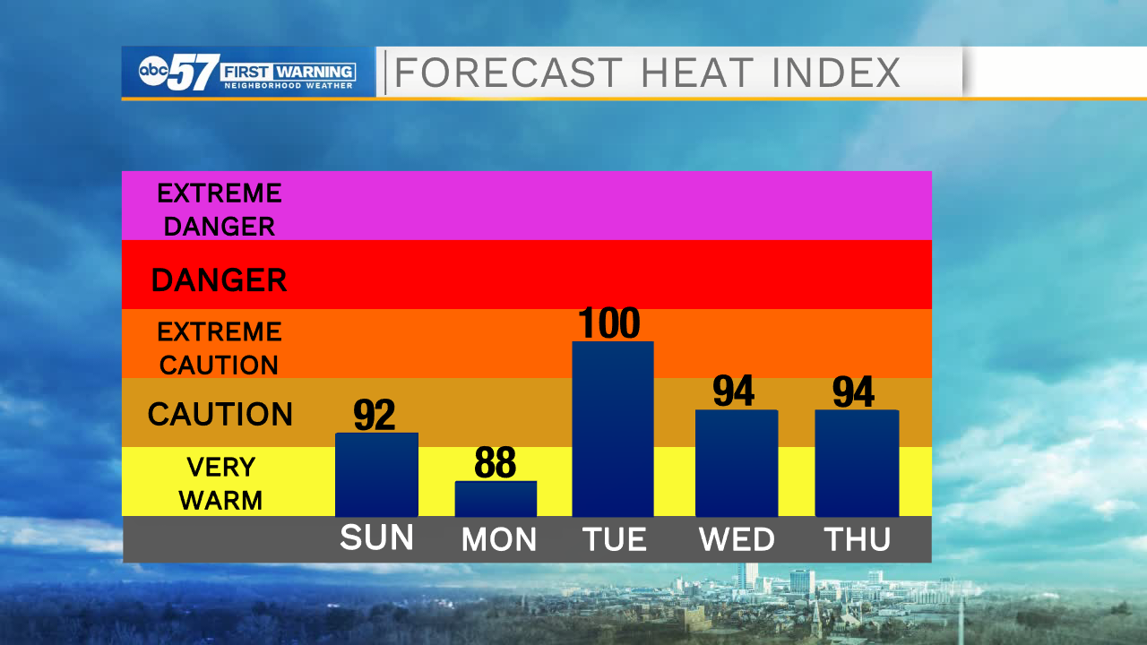
This evening is looking mostly dry but muggy. The humidity in the atmosphere could help to develop a few stray showers and weaker thunderstorms. The rain and storm chance will decrease after sunset. Tomorrow also looks mostly dry, but the heat and humidity will stick around. Highs tomorrow will top out in the lower 90s. The heat index will be in the mid 90s. Sunday night into Monday scattered showers and storms will move into Michiana, and stick around throughout most of the day. Pop up showers and storms will remain in the forecast for the rest of the week. High temperatures will hold in the upper 80s to lower 90s through Thursday, but then a late week cold front swings in bringing more comfortable conditions for next weekend.
Tonight: Partly cloudy. Low 70.
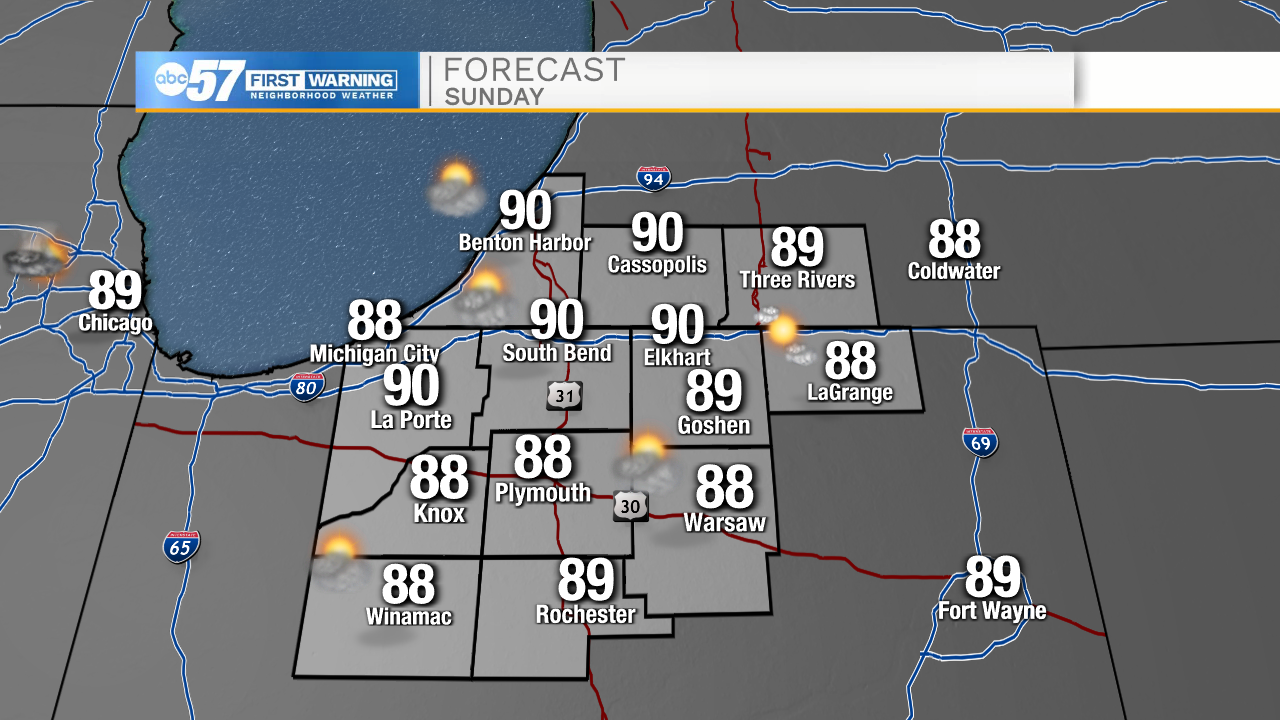
Tomorrow: Partly cloudy. High 90.
Monday: Scattered showers. High 88.
Tuesday: Isolated storms. High 90.