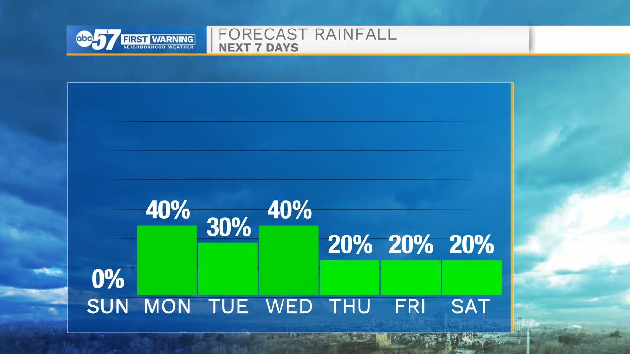
Hot and humid tomorrow afternoon, Storm chances return late Sunday night


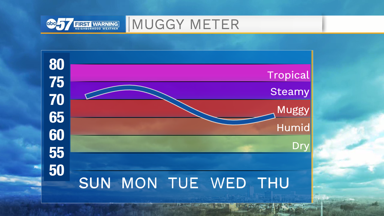
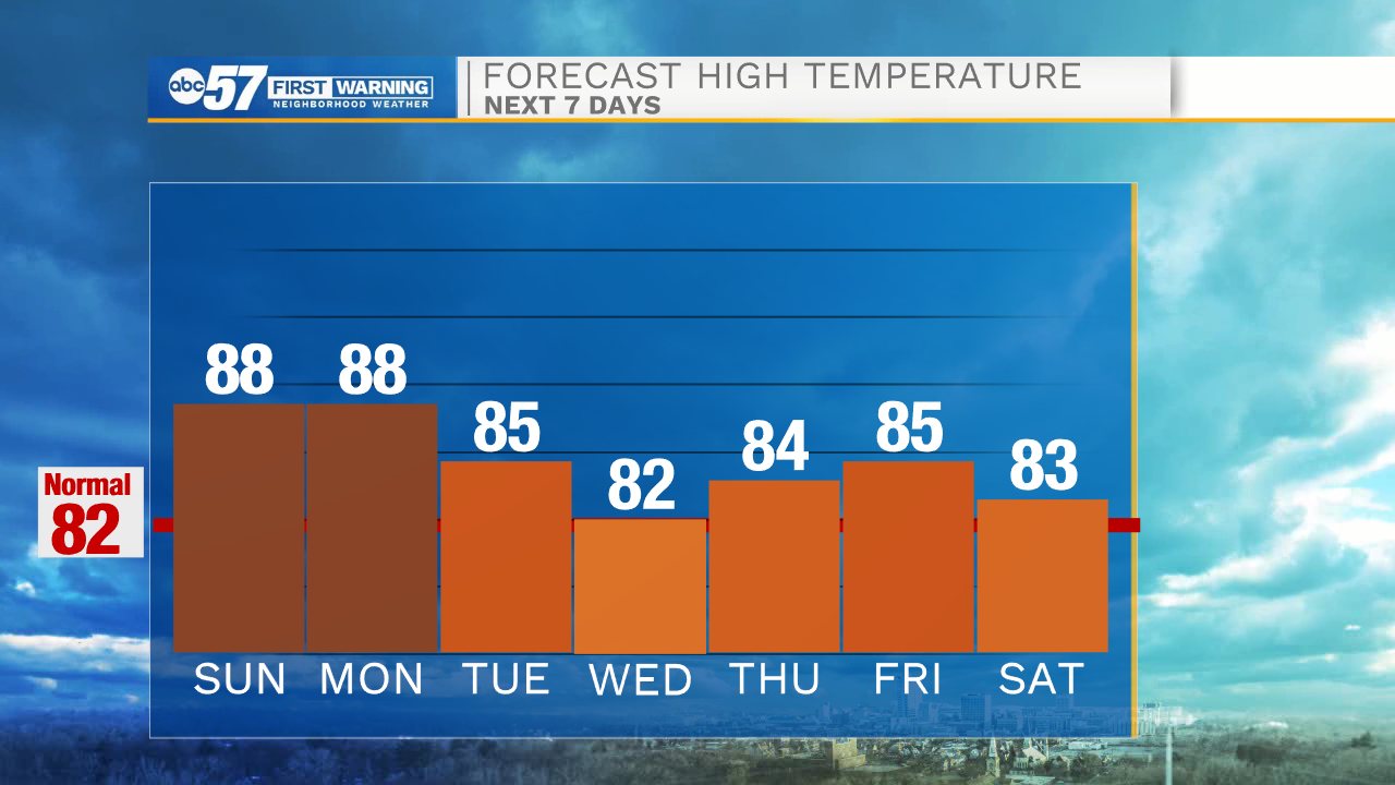
Tomorrow afternoon will be hot and muggy with high temperatures in the upper 80s under mostly sunny skies. The heat index will be in the mid 90s. We will stay dry throughout most of Sunday, but a few isolated showers and storms are possible closer to midnight. The rain and storm activity will persist into Monday morning. We will catch a small break from the rain before more showers and storms are possible Monday evening into Tuesday morning. A few of those storms could be on the stronger side. High temperatures Monday will be in the mid to upper 80s.
More rain showers and thunderstorms are possible Tuesday and Wednesday. Rain chances will stay on the lower side through the rest of the week and into next weekend. High temperatures this week will be in the low to mid 80s.
Tonight: Partly cloudy. Low 68.
Tomorrow: Mostly sunny. Humid. Storm/shower chances late. High 88.
Monday: Scattered thunderstorms. High 88.
Tuesday: Isolated storms. High 85.