
-
2:06

Staying sunny until Thursday
-
0:58

Goshen City Council amends DORA rules amid community concerns
-
1:20

SB Common Council adopts Downtown 2045 Plan
-
2:39

Friends and family celebrate life of Jamecia Moffitt
-
1:15

St. Joseph County Council updates residents on Affordability...
-
0:51

Locals gather to recognize farmworkers across Northern Indiana
-
2:07

Impact of higher gas prices for delivery drivers
-
3:43

ND Eviction Clinic exposes ’shameful’ living conditions at...
-
3:59

Neighbors share traffic, noise concerns about proposed Capital...
-
1:50

Leaf pick up resumes in South Bend after weather postpones service...
-
1:02

Another rollercoaster ride to end the week
-
3:41

Present Pillars to host “Dad Strong 5K“ to support fathers...

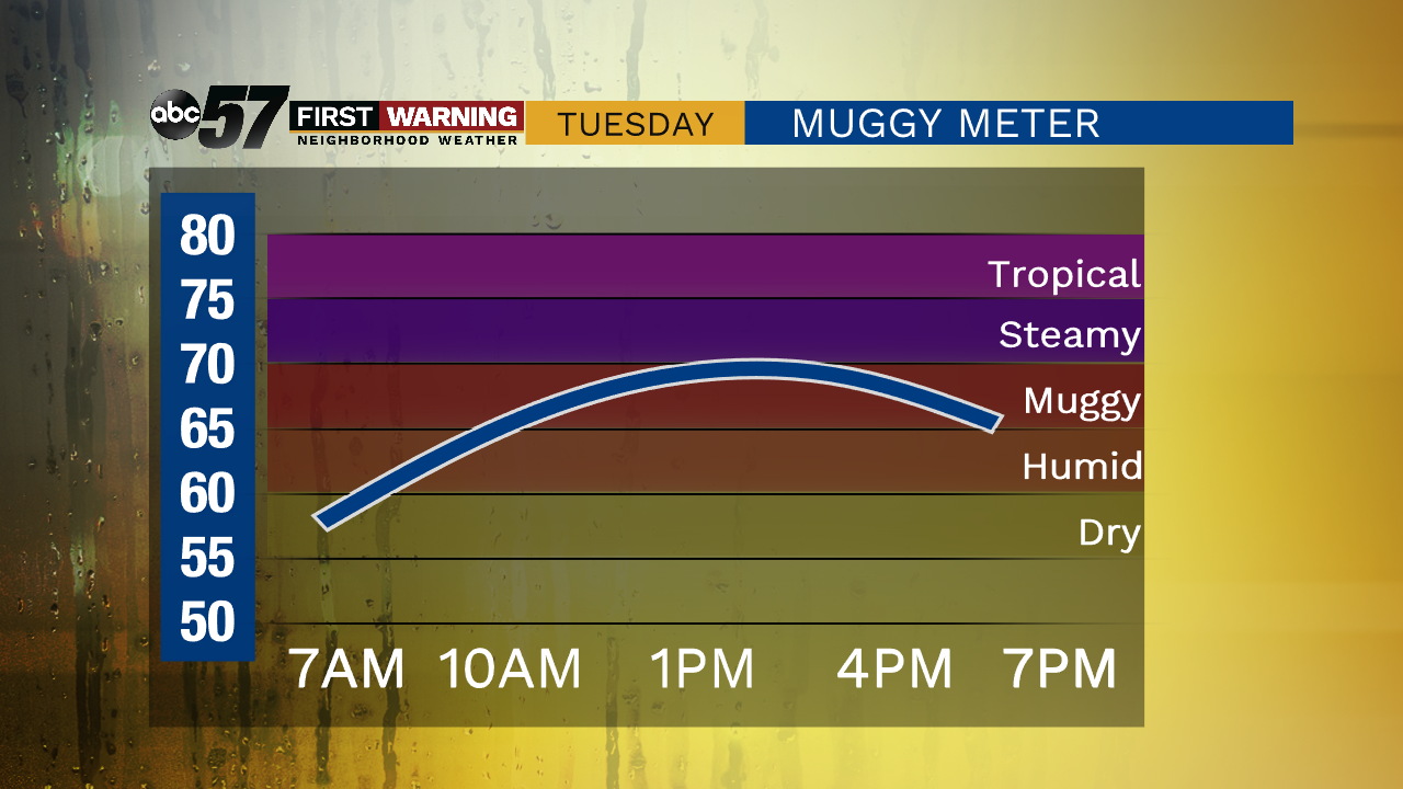
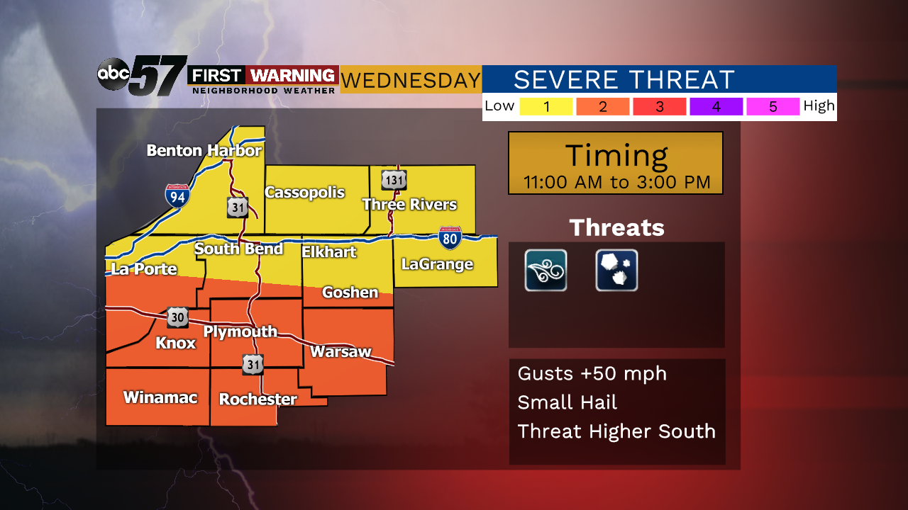
Heat and humidity surges Tuesday as temperatures soar to 90. The steamy weather will fuel scattered thunderstorms Wednesday. A cold front slides through midday Wednesday, that's key because storms will develop around noon and push southward by mid-afternoon. There is the chance of severe weather but it's most likely that threat is across central Indiana in the afternoon. Thursday is fair, Friday another chance of midday storms then a sunny summer weekend.
Tonight: Mostly clear. Low 62.
Tuesday: Hot and humid. High 90.
Wednesday: Scattered midday storms. High 84.
Thursday: Mostly sunny. High 82.
Sign up for the ABC 57 Newsletter