
-
2:15

Severe weather likely for portions of Michiana later today
-
2:34

Open House for a new pedestrian bridge leaves Riverside Residents...
-
2:16

Notre Dame’s CJ Carr embraces growing expectations while leading...
-
2:34

Injuries sideline key linebackers as Notre Dame leans on depth...
-
0:58

U.S. Army increases maximum enlistment age from 35 to 42
-
2:08

Large hail, damaging winds and tornadoes possible Thursday
-
1:40

Nicholas Stanley appears in court, prosecutors push to prevent...
-
3:18

Expert breaks down high gas prices and factors impacting price...
-
2:08

Westview community rallies around boys’ basketball team headed...
-
2:06

The threat for severe weather has increased
-
2:16

More sunshine today with a severe risk tomorrow
-
0:32

Granger residents share input on proposed S.R. 23 roundabout

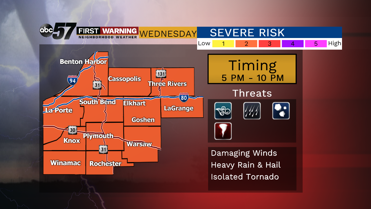
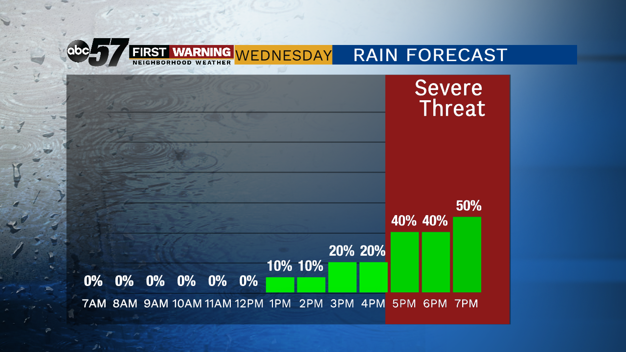
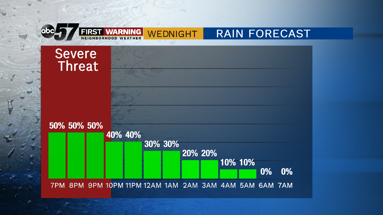
Hot and humid weather returns Wednesday as highs make a run towards 90, the heat index could near 100. A strong cold front will spark thunderstorms by the evening. The window for and severe weather starts around 5:00 p.m. and lasts through the evening. Temperature and humidity drop sharply into Thursday a mild and breezy day in the 70s. The heat builds again through the weekend.
Tonight: Mostly clear, low of 68.
Wednesday: Hot and humid, evening storms likely, high of 90.
Thursday: Mostly sunny and breezy, high of 78.
Friday: Sunny, high of 82.
Sign up for the ABC 57 Newsletter