Hot and humid Wednesday; isolated shower or storm possible late


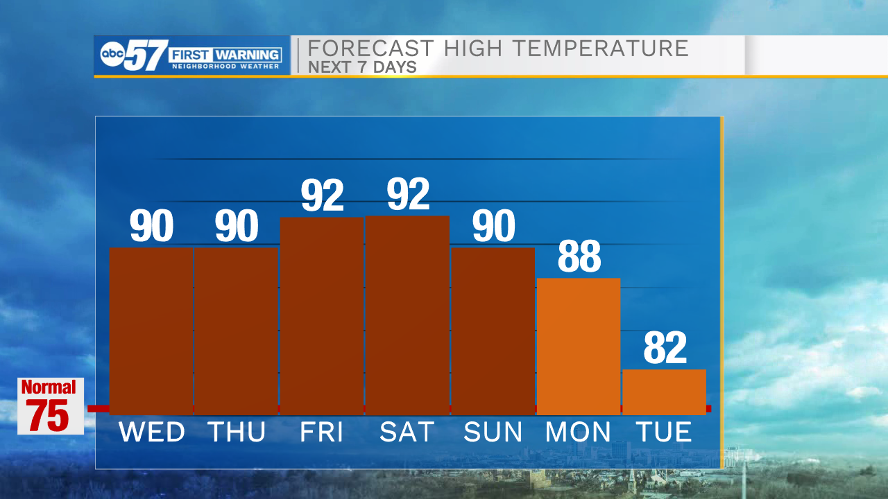
It feels warm and muggy out the door this final morning of the month of May. This afternoon is hot once again with highs near 90.
While it is mainly sunny this morning, a few more clouds develop in the afternoon. We have a slight chance to see an isolated rain shower, possibly a thunderstorm, this afternoon into the evening.
The heat stays on through the end of the week.
The forecast remains mostly dry, although again Thursday afternoon we have a slight chance for an isolated shower or two.
Saturday and Sunday could be a little breezy at times.
After a round of a few rain showers Monday, temperatures next week will cool into the lower 80s or upper 70s.
Today: Partly cloudy. Isolated afternoon shower/thunderstorm possible. High 90.
Tonight: Partly cloudy. Low 64.
Thursday: Mostly sunny. Isolated afternoon shower/thunderstorm possible. High 90.
Friday: Mostly sunny. High 92.