-
3:08

Officials recover body of missing teenager in Lake Michigan off...
-
2:45

NCAA’s new eligibility rule could reshape Notre Dame roster...
-
1:08

Storms start this afternoon
-
0:56

Calm morning, storms tonight
-
2:43

South Bend residents see future plans for former Drewry’s Brewery
-
2:45

Damage assessment continues in Elkhart County following EF-2...
-
0:44

Indiana and Illinois set record for tornadoes
-
1:27

Community Build underway at Kathryn Park
-
2:34

Day two of searching for a missing child continues
-
3:47

The Elkhart community is searching for answers after a 2-year-old...
-
1:04

Overall pleasant for Michiana
-
1:52

South Bend Common Council issues an official apology to residents...

ABC57 First Warning Neighborhood Weather
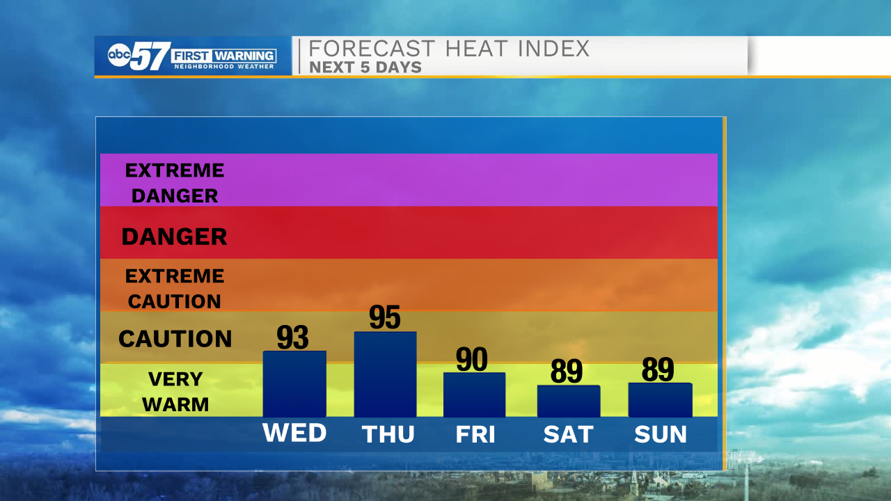
Wednesday, July 8th, 2020
More sunny, hot and humid weather today and tomorrow. Heat indices could reach the upper 90s! Isolated showers and storms are possible again for both days, after midday. A system moves in Thursday night, bringing widespread scattered showers and storms that will last into Friday. This will finally knock down the heat and humidity some for Saturday. Sunday is still in the 80s but more wet weather is expected after midday. Next week starts to warm right back up with 90s possible by next Wednesday.
Today: Mostly sunny, hot and humid. PM isolated showers/storms. High 94.
Tonight: Partly cloudy. Low 73.
Thursday: Partly sunny, hot and humid. PM isolated showers/storms. High 94.
Friday: Scattered thunderstorms. High 87.