Hot and steamy week with thunderstorm chances
By: Emily Kennedy
Posted: Aug 24, 2021 3:09 AM EDT

-
1:16

No shortage of sunshine today
-
1:37

Memorial Day parade forecast
-
4:51

Local band ’The Erly’ stops by ABC57 ahead of June 3 performance
-
1:17

VERY foggy first few hours of the morning
-
1:57

A local taste brings New Carlisle community together on race...
-
0:45

Pancakes help raise funds to support the Alzheimer’s Association
-
1:03

Lighter rain expected into the afternoon
-
1:04

Non-severe storms expected
-
1:16

Showers start this morning
-
1:59

Mac & Cheese festival turns Four Winds Field into a kitchen
-
0:45

Michiana Spring Clay tour encourages people to try and take a...
-
2:56

Fresh Cuts, Fresh Starts: Re-Entry Program Gives Back in Elkhart

ABC57 First Warning Neighborhood Weather Forecast
Tuesday, August 24th, 2021
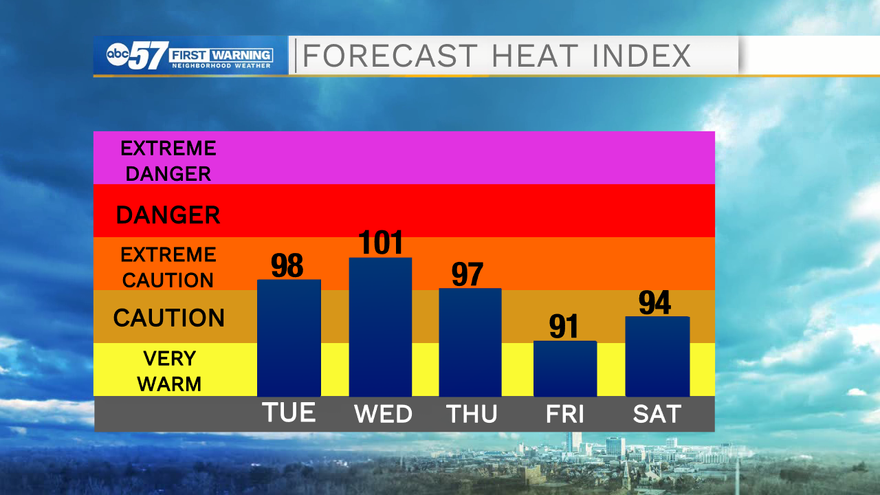
We have a hot and humid week ahead of us. We top out in the low 90s today through Thursday with heat index value near 100F. We settle into an active weather pattern as well with a chance lasting through Friday. We will still have times of sunshine each day, but you will need to stay updated on timing of storms to plan around them. The heat continues into the weekend. We finally see relief from a cold front on Monday.
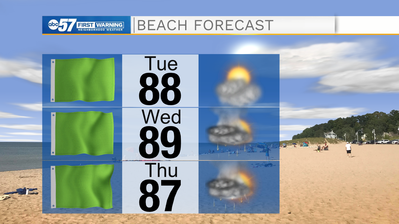
Today: Hot and humid. Isolated PM thunderstorms. High 90.
Tonight: Isolated thunderstorms. Low 74.
Wednesday: Hot and humid. Scattered thunderstorms. High 92.
Thursday: Hot and humid. Isolated PM thunderstorms. High 90.
Sign up for the ABC 57 Newsletter